
Welcome! The Calgary Heritage Initiative presents a series of articles throughout 2025 commemorating the 150th anniversary of the construction of Fort Calgary at the confluence of the Bow and Elbow Rivers, an important meeting place for people for millennia. Each month we’ll present one era in Calgary’s history.
Sign up to CHI’s newsletter and join us to explore the history and heritage of our region.
Calgary’s Prehistory
75 million years ago to 14,000 years ago
Let’s start at the beginning. Not quite back to the Big Bang, but a good time is when Calgary and region were submerged by a primordial seaway.
Seaway
The Dinosaur Age ended 66 million years ago when a meteorite impact changed the face of the Earth forever. During the last period of this Age, the Cretaceous Period, today’s prairie region was underwater in what is called the Western Interior Seaway. It stretched from the Arctic Ocean to the Gulf of Mexico, dividing the continent in half.
The Seaway maintained a relatively temperate and humid climate in this part of North America. Running along the newly forming Rocky Mountains was a lush coastline, with tropical forests, marshes and wetlands bordering the young mountain range.
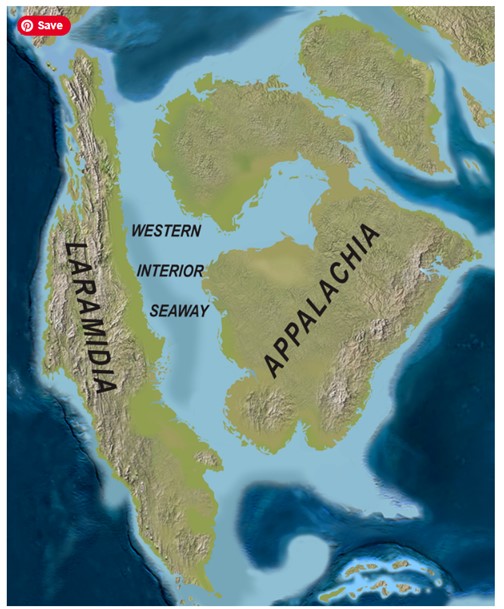
Map of North America with the Western Interior Seaway during the Upper Cretaceous, about 75 million years ago (Scott D. Sampson, et. al., 2010, via Creative Commons Attribution 4.0 International license)
Rockies
The Rocky Mountain range is special because it’s not located in a tectonically active spot, unlike the Himalayas. This mountain range is right now being pushed upward because the Indian Plate is moving northward into the Eurasian Plate. On the other hand, the Rockies are located in the middle of the North American Plate.
So what caused them to rise? Starting 75 million years ago, a dense tectonic plate under the Pacific Ocean began to slide slowly and shallowly underneath the North American Plate. It moved quite far eastward before eventually descending into the mantle. As water was released into the crust, followed by magma, the Earth’s surface was pushed up, forming the rugged landscape of Western North America, which culminates as the Rocky Mountains.
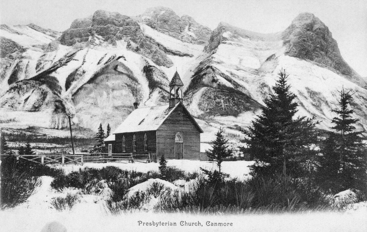
Presbyterian church, Canmore, AB, ca. 1910 (Glenbow Library and Archives Collection)
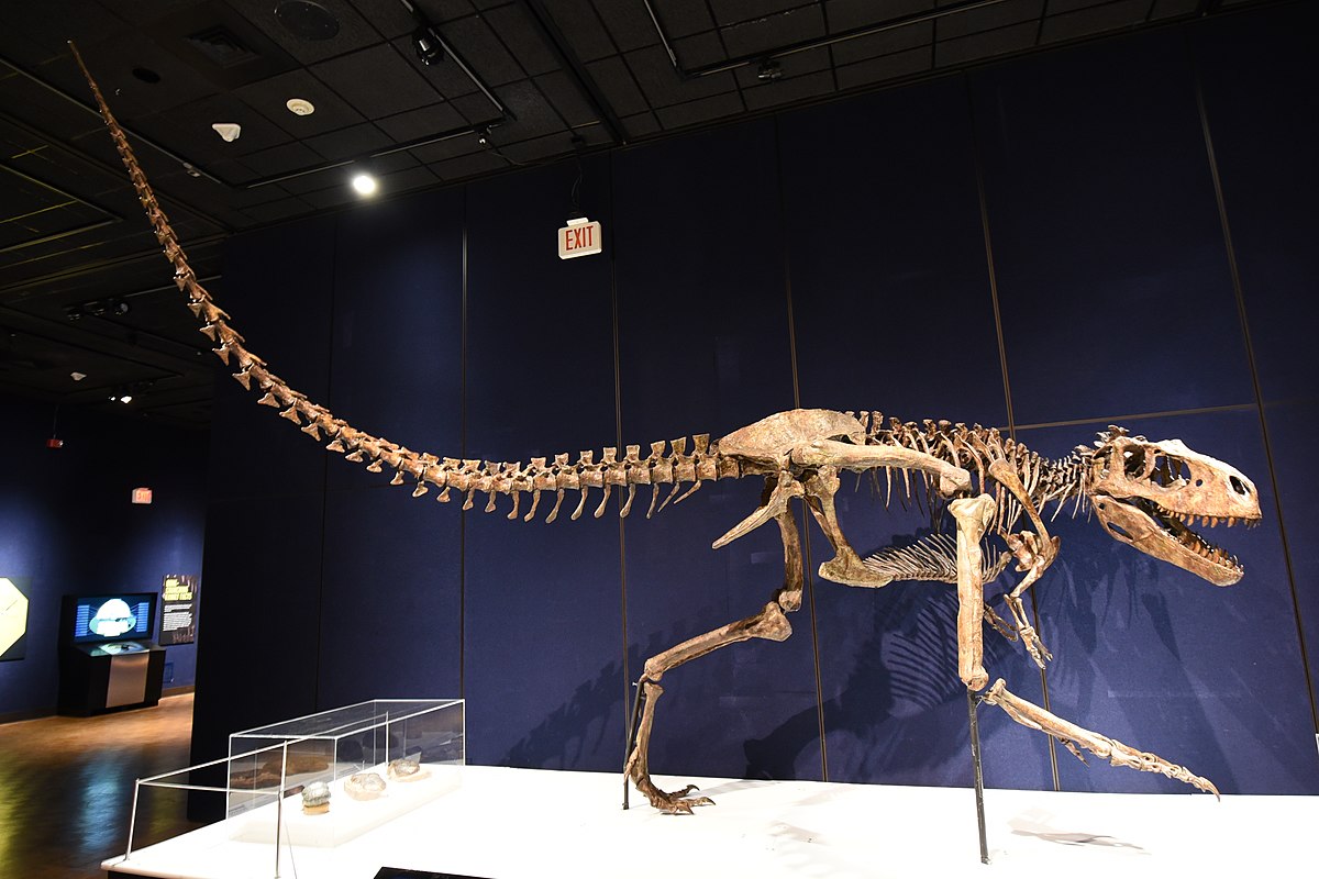
Dinosaurs
The Western Interior Seaway was a warm shallow sea filled with marine life, including plesiosaurs as well as sharks, the giant bony fish Xiphactinus, molluscs, and ammonites. Early birds, such as giant pterosaurs and Ichthyornis with its toothy beak, were present.
On its shores, dinosaurs ruled. Some of them, like the duck-billed hadrosaur called Edmontosaurus, fed on lush foliage whereas others, like Albertosaurus, hunted these herbivores.
All this life was preserved by the shallow lake. For millions of years, runoff and sediment covered the skeletons of the dinosaurs for palaeontologists to uncover as fossils.
Today, Alberta – the Drumheller area in particular – is one of the richest dinosaur study areas in the world, producing about half a dozen new skeletons every year. There is also rare evidence of dinosaur behaviour, including nesting sites and migration tracks.
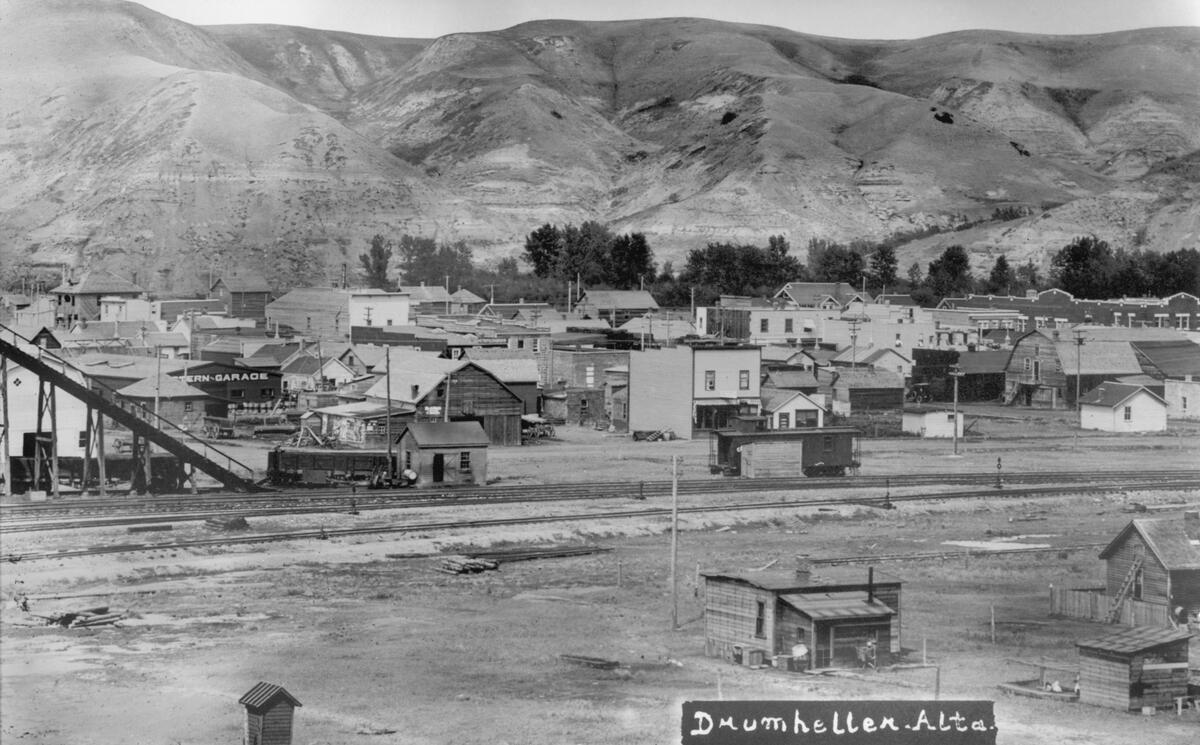
General view of Drumheller, AB, ca. 1920 (Glenbow Library and Archives Collection)
Tyrrell
You can see a treasure trove of fossils and learn about Alberta’s prehistory at the Royal Tyrrell Museum. Founded in 1985 and receiving royal designation in 1990 from Queen Elizabeth II, it’s Canada’s only museum dedicated to the study of ancient life.
The Museum is named after Joseph Burr Tyrrell, who worked for the Geological Survey of Canada. While investigating coal seams near Drumheller in 1884, he found a skull that turned out to be from Albertosaurus, a smaller member of the Tyrannosaurus family.
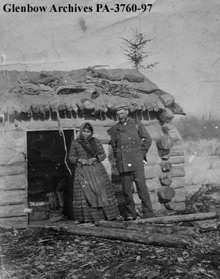
Geologist Joseph Burr Tyrrell buying moccasins from a Dogrib woman, Fort Resolution, Northwest Territories, ca. 1905 (Glenbow Library and Archives Collection)
Oil and Gas
Besides their scientific value, fossils are valued for the fuels that have driven over two centuries of technological development. Alberta is rich in fossil fuels, and for that we can thank the Seaway that once covered our region.
Sea life interacted and evolved for millions of years. Creatures with soft bodies flourished first, but they had no bones, meaning there are no fossils to dig up. Rather, we see the impressions of their boneless bodies in the Burgess Shale, near Field, B.C.
This area is one of the most important fossil beds in the world. It holds evidence of the origins of many modern animal groups, an event called the Cambrian Explosion. This refers to the sudden appearance of complex organisms in the fossil record about 540 million years ago.
When the Burgess Shale was preserved about 50 million years later, creatures with hard shells were present. These shells ended up forming layers on the seafloor. Giant coral reefs also grew, adding more porous layers, within which would eventually be stored oil and gas.
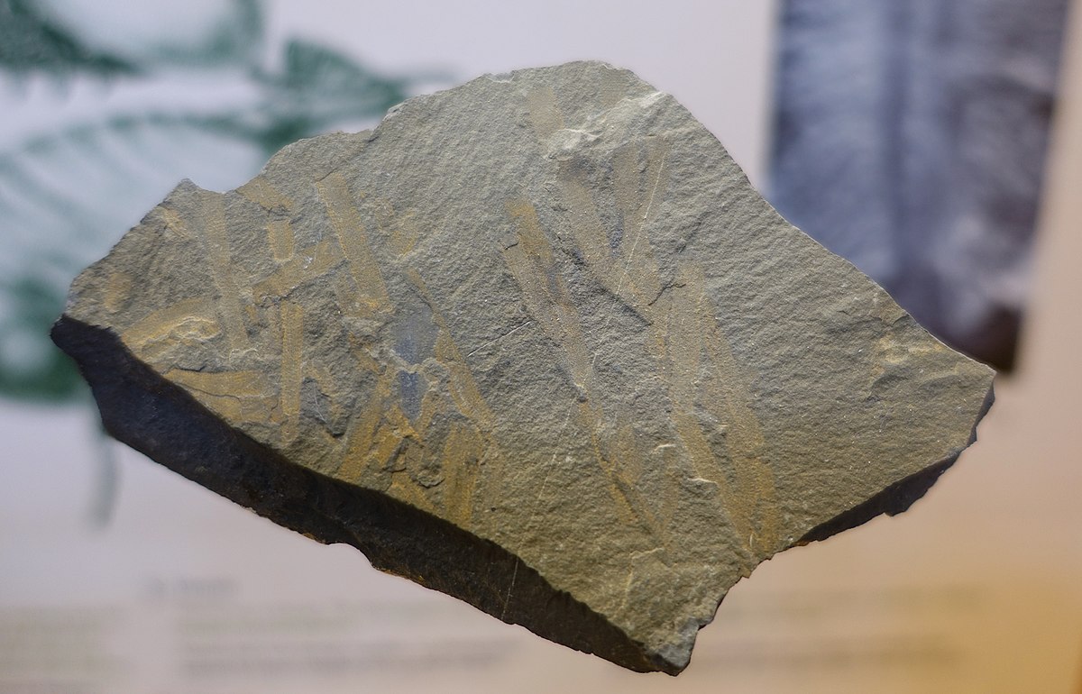
Exhibit of Vauxia (a type of sponge) from the Burgess Shale, located in the Redpath Museum, McGill University, Montreal, QC, 2016 (Daderot, via Creative Commons CC0 1.0 Universal Public Domain Dedication)
Over many more millions of years, all that sealife settled to the seafloor as layers of organic sludge rich in hydrogen and carbon, which was stored in the porous rocks. When subjected to different amounts of heat and pressure, the sludge turned into either natural gas or liquid crude oil. A layer of shale rock prevented the fuels from escaping.
In Turner Valley in 1914, wet natural gas sprayed out of the wellbore at Dingman No.1. Then the Leduc-Rimbey reef became famous for Leduc No.1, Alberta’s 1947 oil strike that launched the province onto the world stage.
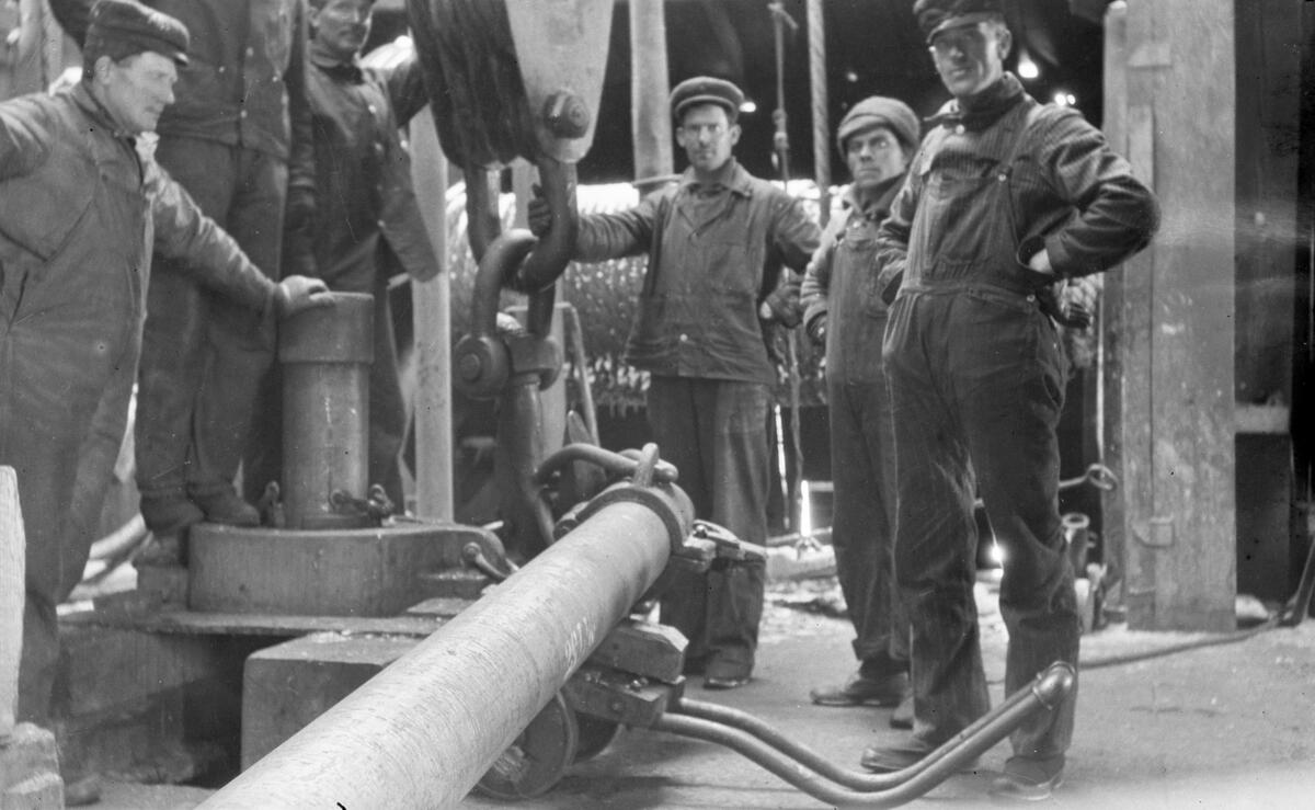
Drillers at Dingman #1 well (Calgary Petroleum Products #1), Turner Valley, AB, ca. 1914-1917 (Glenbow Library and Archives Collection)
Ammolite
There’s one more famous product from Alberta’s prehistory to mention. Among all those sea creatures were ammonites. These were spiral shelled cephalopods, a creature related to the modern-day squid.
Again, after millenia of sediment deposits, some shells became iridescent, meaning they display luminous colours that change when seen from different angles. And since human beings are dazzled by bright, beautiful and colourful objects, Alberta is on the map for producing a unique, organic gemstone (akin to ivory or pearl).
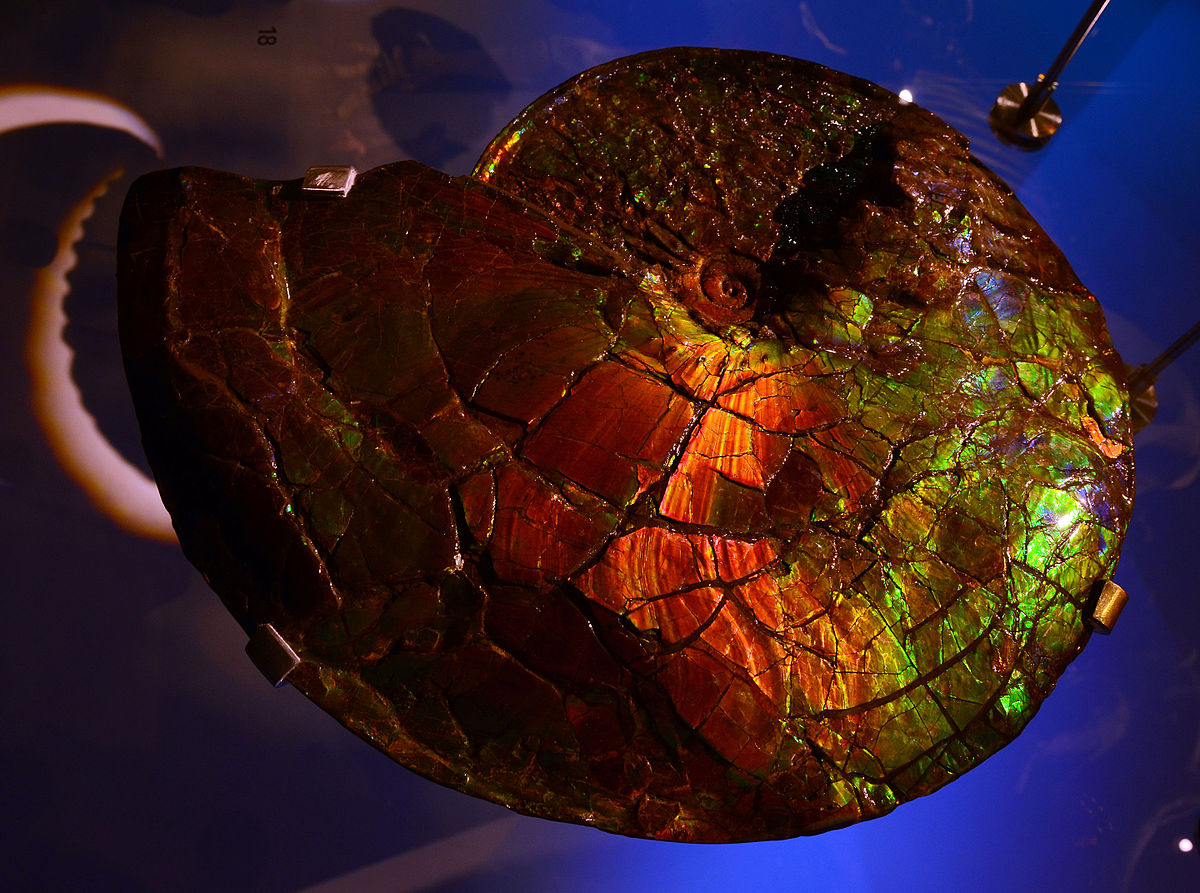
Placenticeras meeki, an ammonite species from the Cretaceous, 80 million years old. Origin: Alberta. Displayed at the Musée des Confluences, Lyon, France. (Vassil, via Creative Commons CC0 1.0 Universal Public Domain Dedication)
The best grades of ammolite are found along the rushing rivers coming off the eastern slopes of the Rocky Mountains, the ancient shoreline of the Seaway. The vast majority of the world’s supply originates from the Kainai Reserve, southwest of Lethbridge, AB.
The Kainai of the Blackfoot Confederacy know ammolite as iniskim (“buffalo stone”). Their legend tells of the first Buffalo Stone saving an entire clan from starvation. Iniskim is also believed to possess healing powers and is incorporated into medicine bundles for use in ceremonies.
Ammolite was first formed into a commercial jewellery product in 1976 and it gained gemstone status in 1981. It became Lethbridge’s official gemstone in 2007, and then in 2022, ammolite was designated the official gemstone of the Province of Alberta (for your interest, the province’s official stone is petrified wood).
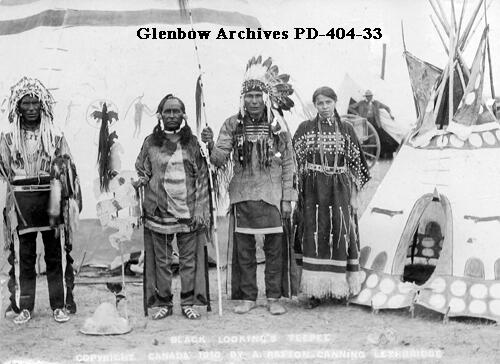
Black Looking’s tipi, Lethbridge, AB, 1910 (Glenbow Library and Archives Collection)
Lake Agassiz
Let’s jump forward a few million years to about 14,000 years ago, when the last Ice Age was ending. Lake Agassiz covered southeastern Manitoba, northwestern Ontario, northern Minnesota, eastern North Dakota, and central Saskatchewan. It held meltwater from the 3 km-thick Laurentide Ice Sheet, which acted as an ice dam that prevented water from flowing north into Hudson Bay.
At some point, water broke through the ice dam with tremendous force and speed. It flooded northern Alberta through the Fort McMurray area and into the Mackenzie River, bound for the Arctic Ocean. It was one of the largest flood events on Earth, and contained so much water it helped prolong the Ice Age. It’s also the source of Alberta’s great oil sands deposits.
Ice Age
The Ice Age is named of course because of the massive ice sheets that covered the northern hemisphere. Up to 97% of Canada is estimated to have been covered in ice, with only the highest mountain peaks and the Cypress Hills having never been glaciated.
Waterton Lakes National Park contains shining examples of glaciation evidence, including
- cirques: bowl-shaped depressions carved by glaciers in the sides of mountain valleys, see Cameron Lake;
- kames: small, irregularly shaped hills formed from deposited material, see the location of the Prince of Wales Hotel; and
- eskers: winding ridges formed by sediment deposited by glacial meltwater, see the buffalo paddock.
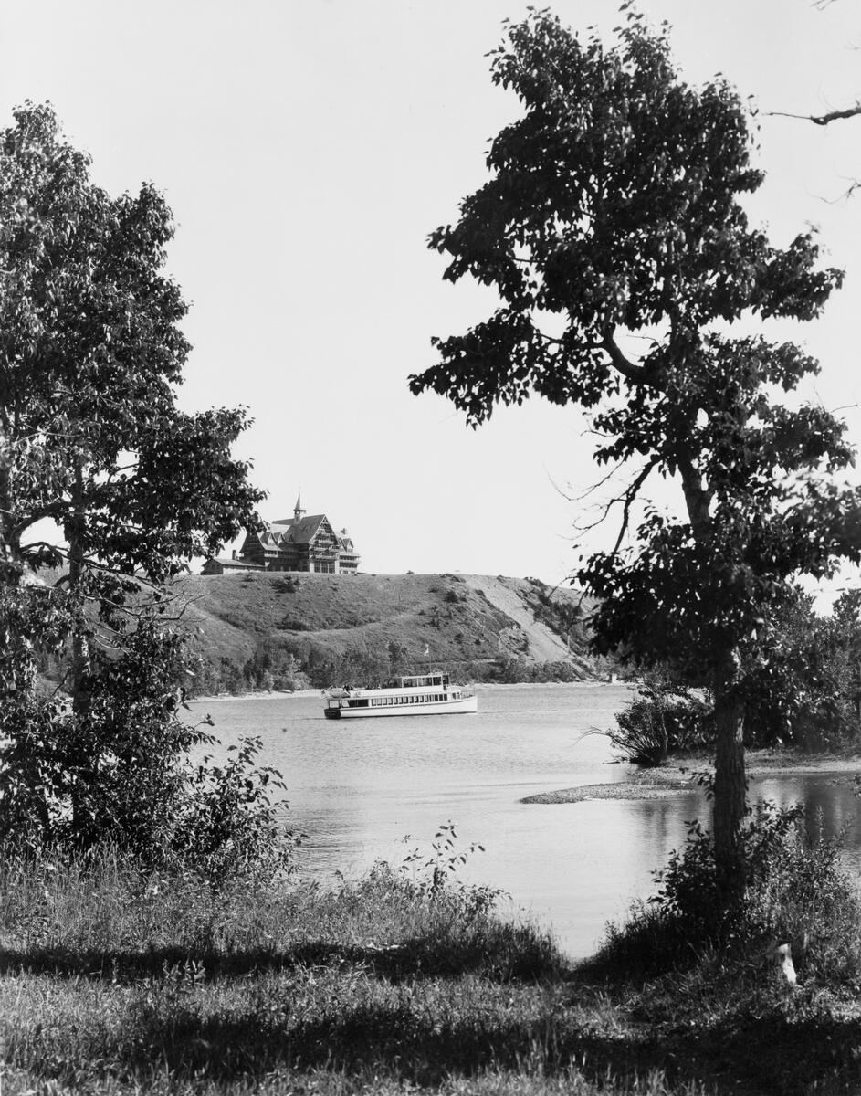
Prince of Wales Hotel, Waterton, AB, ca. 1930s (Glenbow Library and Archives Collection)
Erratics
Another sign of glaciation is the seemingly random placement of large boulders called erratics. As the name implies, these large rocks look out of place, as if haphazardly placed by a walking giant.
What really happened? These erratics were carried by expanding ice sheets from their original location and then deposited elsewhere when the sheets receded. We know they travelled because these rocks contain material not native to the areas they now occupy.
The Calgary region is littered with erratics from Jasper National Park, referred to as the Foothills Erratic Train. About 30,000 years ago, a landslide deposited 600 million-year-old rocks made of quartzite onto an expanding ice sheet. When the ice melted, these rocks found new homes where there is no quartzite.
The largest and most famous of the Foothills erratics is Big Rock near Okotoks, AB. The town is so named from the Blackfoot word for “rock”, okatok.
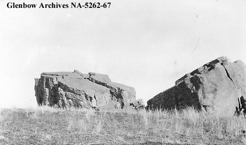
Big rock, Okotoks, AB, ca. 1914-1917 (Glenbow Library and Archives Collection)
As legend has it, Náápi, the Blackfoot peoples’ culture hero, laid his robe on the rock. When he asked for it back, the rock refused. Náápi grabbed it and ran, but the rock rolled after him. Náápi called for help and a colony of bats started assaulting the rock. They succeeded in splitting it down the middle, stopping its roll in the middle of the prairies.
An erratic found in Calgary near Coventry Hills is the Beddington Erratic. Now covered in graffiti, it was once identified as having markings called pictographs. Indigenous peoples used these giant rocks as landmarks and treated them as sacred places. Efforts to protect it are underway.
Migration
Possibly the most important effect of the Ice Age was to expose a land bridge linking Eurasia and North America. This bridge, now under the waters of the Bering Strait, was last above sea level for around 5000 years, until ice sheet meltwater eventually raised the ocean level and subsumed the bridge. Yet it was enough time for an estimated few thousand modern humans to cross over, probably following herds of woolly mammoth and other megafauna, key food sources in the far north.
These Paleolithic (Stone Age) hunter-gatherers spread across the Americas, with evidence of their presence dating back approximately 14,000 years. Currently there’s debate whether the first peoples arrived even earlier, perhaps over 20,000 years ago.
But for now, let’s look forward to next month’s article on the peopling of the prairies.
– Anthony Imbrogno is a volunteer with The Calgary Heritage Initiative Society/Heritage Inspires YYC
– All copyright images cannot be shared without prior permission
Where to See This Era
Banff and Jasper National Parks
- Banff Visitor Centre, 224 Banff Ave, Banff, AB T1L 1B3
- Jasper Visitor Experience Centre, 414 Patricia St, Jasper, AB T0E 1E0
Canadian Rockies Earth Science Resource Centre, 111 – 829 10 Street, Canmore, AB, T1W 0C4
The Royal Tyrrell Museum of Palaeontology, Midland Provincial Park, 1500 N Dinosaur Trail, Drumheller, AB T0J 0Y0
Dinosaur Provincial Park, Township Road 210A, Patricia, AB
Yoho National Park Visitor Centre, 5764 Hwy 1, Field, BC V0A 1G0
Turner Valley Gas Plant National and Provincial Historic Site, Sunset Blvd SE, Diamond Valley, AB T0L 2A0
Waterton Lakes National Park Visitor Centre, 404 Cameron Falls Dr, Waterton Park, AB T0K 2M0
Okotoks “Big Rock” Erratic, Highway 7, between Okotoks and Diamond Valley, Foothills County, AB
See here for a list of erratics in Calgary
Further Reading
Aritha van Herk, Mavericks: An Incorrigible History of Alberta, 2002, Penguin Canada.
“100 million years ago, Alberta was a giant sea”, CBC News
Geology of the Western Interior Seaway
For a rough timeline of the Calgary area, visit https://foothillsandvalleys.wordpress.com/timeline/
Very good article. Love the prehistoric references and how Calgary and the surrounding regions were formed. Also very cool to see how the names of certain places came about.