
Welcome! The Calgary Heritage Initiative presents a series of articles throughout 2025 commemorating the 150th anniversary of the construction of Fort Calgary at the confluence of the Bow and Elbow Rivers, an important meeting place for people for millennia. Each month we’ll present one era in Calgary’s history.
Sign up to CHI’s newsletter and join us to explore the history and heritage of our region.
Stampede City
1900 to 1914
Calgary’s pace of change today mirrors what happened during the early 20th century. Between 1901 and 1911, there was a tenfold increase in population, from 4398 Calgarians to 43,706.
Growing
The Town of Calgary lasted 10 years and the City is still going strong. Indeed, we are currently having a back to the future moment, what with the incredible population growth Calgary and Alberta have seen over the past few years.
Such rapid growth brought about changes that moved Calgary away from its land-based origins – a place of buffalo herds, agriculture and ranching. Calgary was becoming a crossroads, both east to west from Winnipeg to Vancouver, and north to south, from the U.S. border to Edmonton.
When the CPR offered preferred freight rates on goods shipped to the city, the boom times were on. These rates were not without controversy, since Westerners then had to pay to ship goods out, and their own goods were subject to a higher shipment rate than was charged in Central Canada. Grievances over these policies reverberate in Albertan society and politics to this very day.
The growth and diversification of Calgary led some to start thinking about ways of remembering the rapidly receding past. Their hope was to keep Calgary’s prairie roots close to the city’s heart.
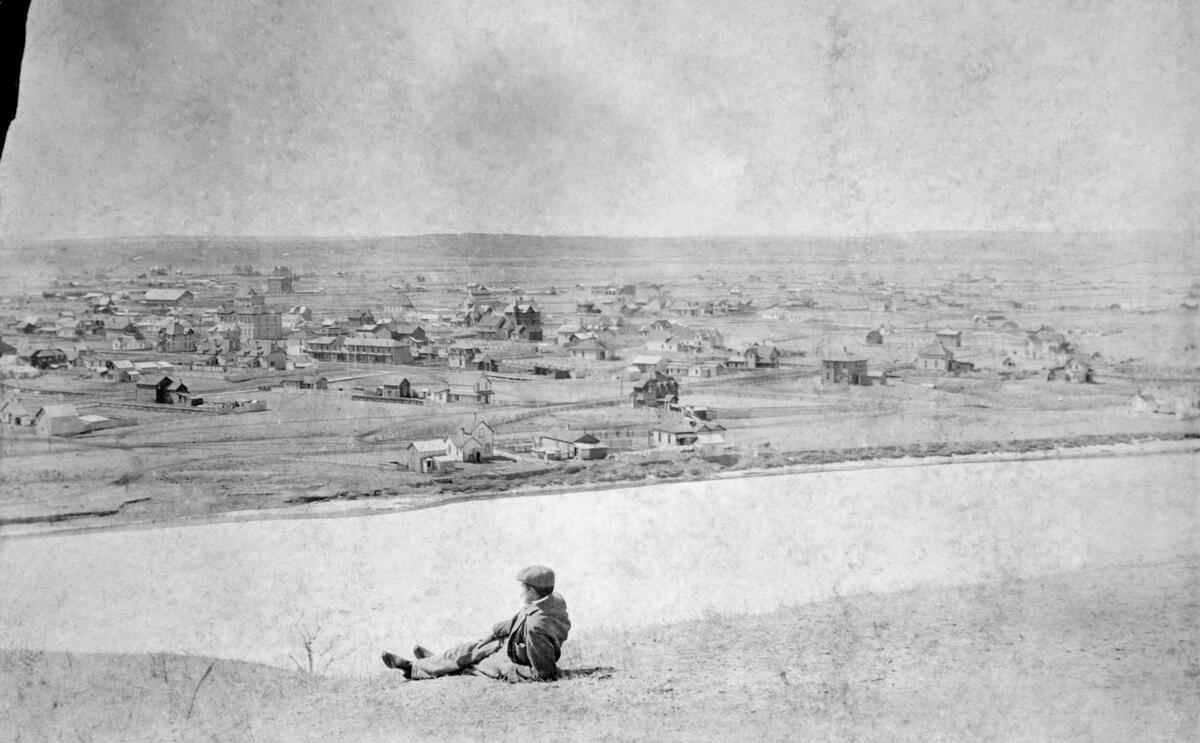
To understand how Calgary became Stampede City, let’s look at life here at the turn of the last century, which corresponds to the founding of Alberta in 1905 – the 8th province of Canadian Confederation.
Surrounding Towns
Along with the areas of Inglewood, Victoria Park, the downtown core and the nearby settlements of Bridgeland-Riverside and Rouleauville/Mission, homesteads and fledgling communities also started appearing all over the Calgary region, mostly along the transportation corridors.
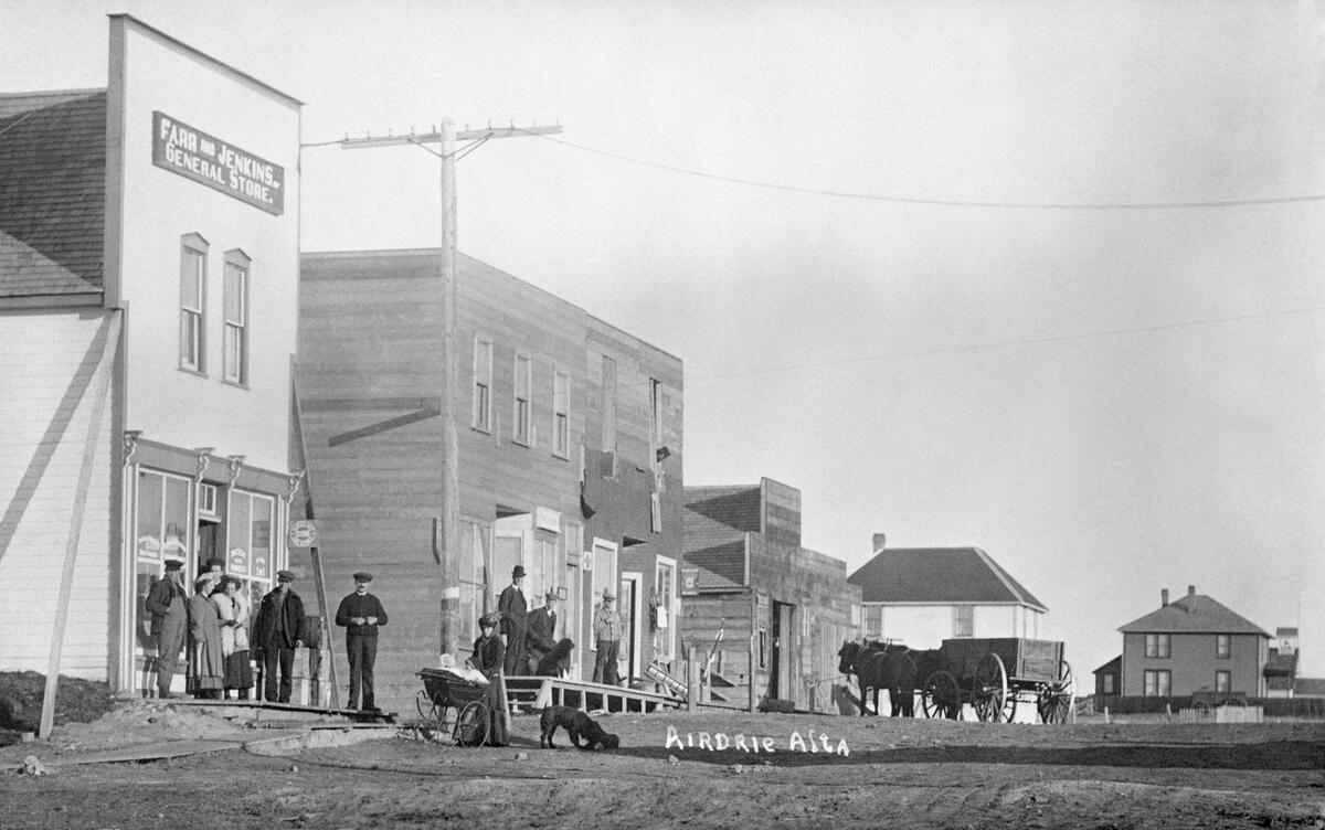
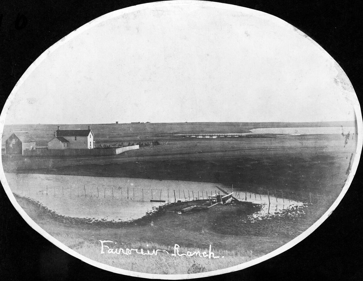
Airdrie is today a bedroom community north of Calgary. It began as a railway siding in 1889 during the construction of the Calgary and Edmonton Railway and it served as a stopping point for steam engines to refill with water.
For a decade, only the railway was in Airdrie until a farm, post office and store that served railway workers and nearby ranches appeared in 1901. By 1909, the town, named for a village in Scotland, was incorporated. The Nose Creek Bridge is the last remaining structure associated with the railway.
Canmore too was founded because of the railway. During its construction in 1884, workers began mining coal in the area for the CPR’s train engines. It’s because of the mine that Canmore today is just outside Banff National Park.
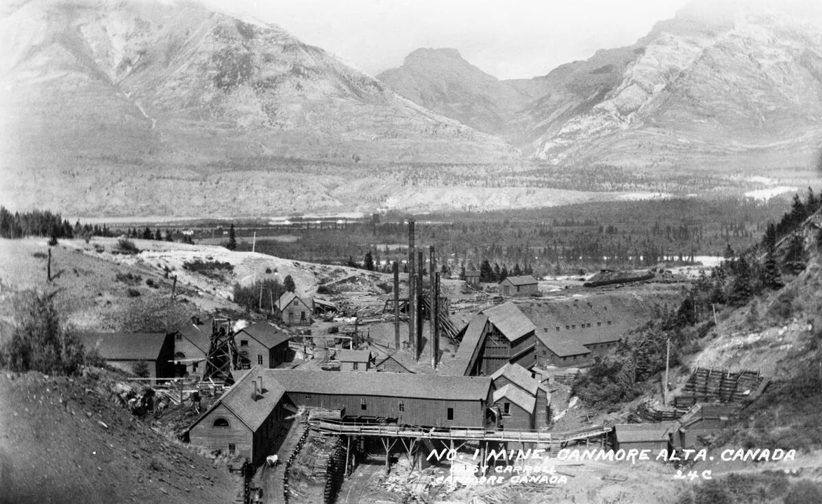
The town was named by CPR director Sir Donald A. Smith in honour of King Malcolm III of Scotland (ca.1058 to 1093), who was nicknamed Ceann Mór (“Big Head” in Gaelic, which was a way of saying “Big Chief”). To the Stoney Nakoda, Canmore is known as Châ Ûpchîchîyen Kudebi (“shooting at the willows”).
Canmore Hotel was built in 1890 and a NWMP barracks was installed in 1893 to stop illegal liquor trading. Both buildings are accessible today.
Of course Canmore is famous for the Three Sisters Mountains. They were originally referred to as the Three Nuns, since after a heavy snowfall they may resemble the habit worn by nuns. Individually they are known as the Big Sister (Faith), Middle (Charity) and Little Sister (Hope). Sometimes they are called Frances, Olive and Grace after the daughters of George Stewart, the first superintendent of Rocky Mountain (Banff) National Park.
Nearby is Ha Ling Peak, named after a railway worker who climbed it in less than 10 hours in 1896. Also close is Grassi Lakes, named after an Italian coal miner and avid hiker. A rock canyon nearby contains spectacular examples of Indigenous rock art using red ochre.
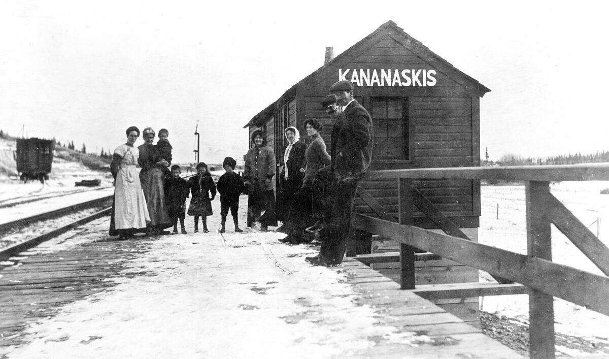
East of Canmore is Kananaskis Country. It’s named after the river, which was named by Captain John Palliser after Kineakis, a Cree man who he had seen survive an axe blow to the head.
The area was part of Rocky Mountains National Park in 1902, was removed in 1911, and turned over to the provincial government in 1930. Bow Valley Provincial Park and Bragg Creek Provincial Park were created in 1960. Support from Albertans to expand environmental protections on the eastern slopes of the Rockies led Premier Peter Lougheed in 1978 to set aside new environmental reserves. Today, Kananaskis Country and Kananaskis (now Peter Lougheed) Provincial Park balance the needs of industry, ranching, tourism and conservation.
Since we’re going counterclockwise around Calgary, let’s stop in next at Bragg Creek. In 1894, Albert Warren Bragg from Nova Scotia received his grant to homestead the area with his brother. They built a small cabin next to a creek, but left soon after due to the area’s isolation.
Bragg Creek remained a ranching community for some decades. A post for trading with the Stoney Nakoda was built in 1927 and remains today.
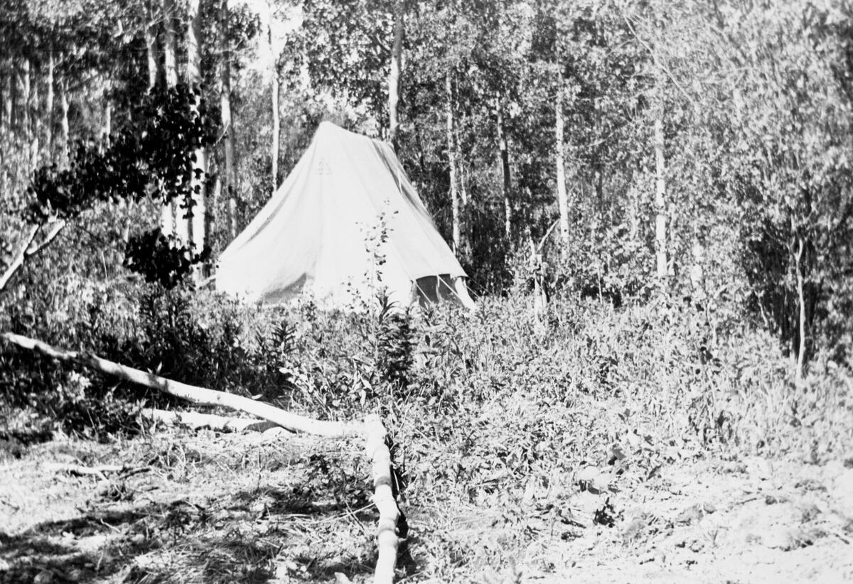
Recreational opportunities in and around Bragg Creek started taking shape in the 1920s given the widespread adoption of the automobile and its proximity to Calgary. In 1934, Mary Belle and Catherine Barclay established the Bragg Creek Hostel in a tent, modelling it after hostels Catherine saw while travelling Europe. It’s considered the first hostel in North America and the birthplace of the Canadian Youth Hostels Association. In the 1990s, the area became famous for hosting the filming of the CBC TV Drama, North of 60.
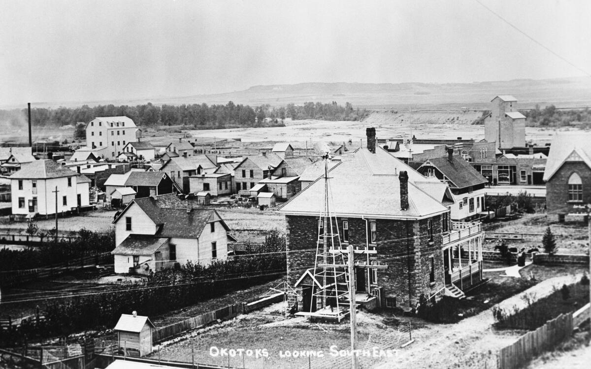
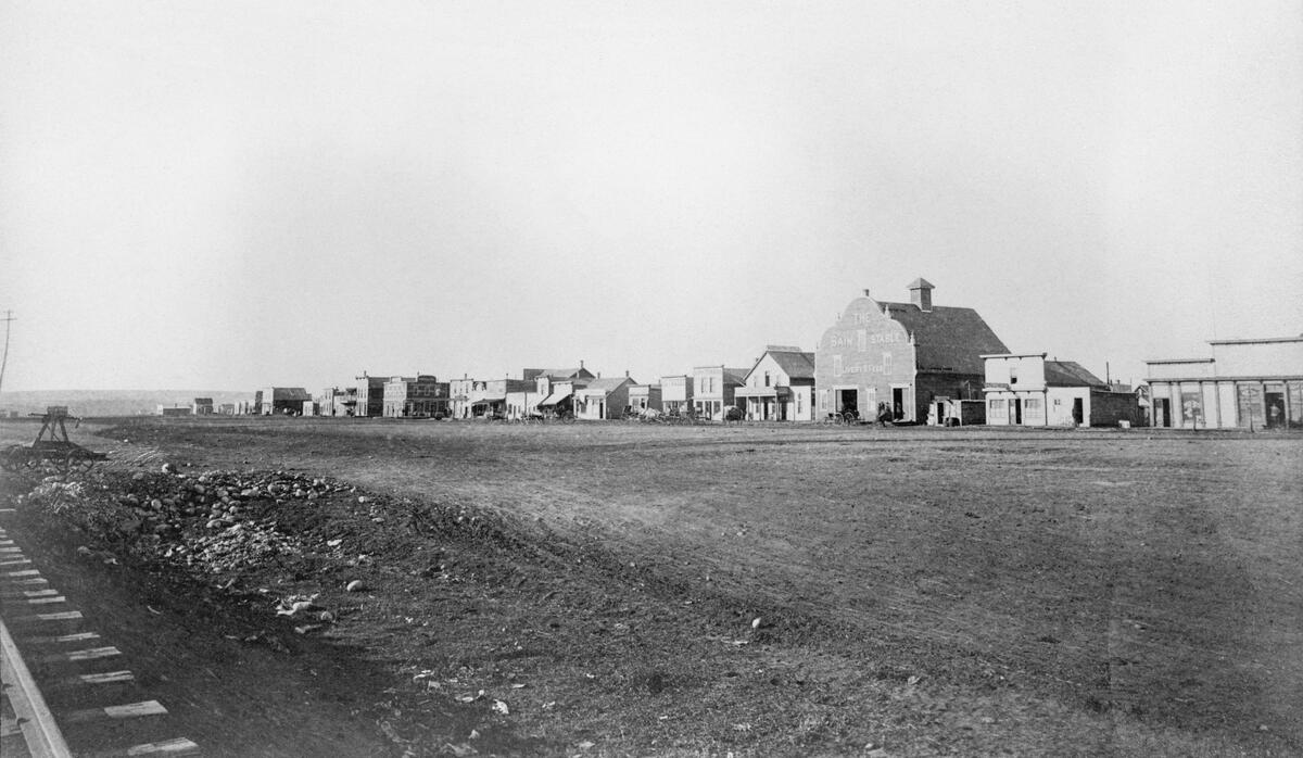
South of Calgary is Okotoks. It was the location where wagons crossed the Sheep River along the route between Fort Macleod and Fort Calgary, part of the pre-rail supply line to Fort Benton, MT and the ancient route the Old North Trail.
Stopping houses popped up to serve travellers in 1882, which attracted more settlement. John Lineham established a sawmill in 1891 and the railway to the U.S. arrived in 1892. It was first named Sheep Creek and then Dewdney, but a town with that name already existed in the NWT’s postal records and so locals chose the name Okotoks (for more on Big Rock, see January’s article).
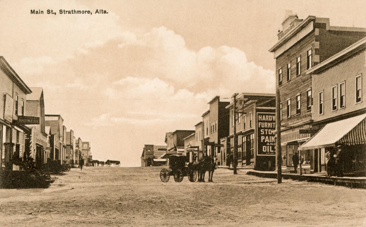
Strathmore and Chestemere both lie due east of Calgary. At Strathmore, the CPR arrived in 1883 and founded a hamlet for workers and newcomers. The CPR named it after the Earl of Strathmore, Claude Bowes-Lyon, who was the great-grandfather of Queen Elizabeth II.
At Strathmore, the record for the most amount of track laid in one day for the CPR was set on 28 July 1883 when workers laid 14 km of track. In 1905, the town itself was moved northward from the original CPR siding to align with a new irrigation system for an experimental farm, giving Strathmore its motto as “the town that moved”.
The Chestermere area was a natural wetland, making it an attractive area for farmers to establish homesteads. The first to set up was the Sullivan family in 1882.
The arrival of the railway attracted more settlement. In 1907, a dam and canal system were built, with the wetland turning into Chestermere Lake. This led to opportunities for recreation close to Calgary. Eventually a “summer village” was incorporated in 1977.
Meanwhile in Calgary
Having lost out to being Calgary’s downtown when the CPR station was built west of Fort Calgary, Inglewood did eventually develop its own commercial street during the early 20th century boom years.
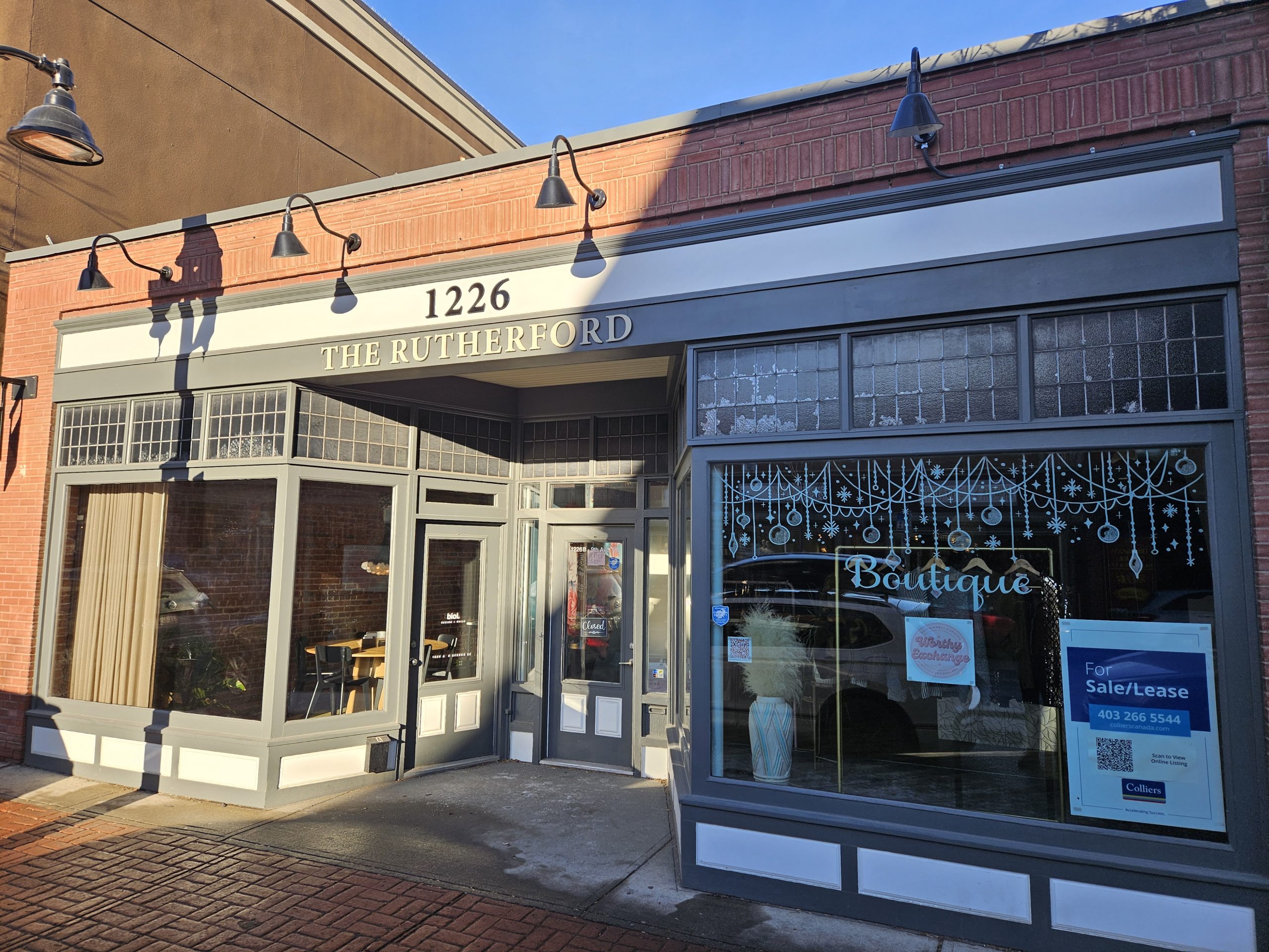
Believed to be the earliest commercial building on Atlantic Avenue today, Rutherford Hardware dates back to 1901. It’s a 1-storey woodframe, single-bay storefront that operated as a hardware store for over 60 years starting in 1908.
Another of the earliest commercial blocks was Black Block. James Black from Ontario constructed the wooden building clad in pressed tin for his grocery business in 1904. Since then it’s been in continuous use as a mixed-used commercial and residential building.
Across 11 St SE is Old Fire Hall No.3, which operated from 1906 to 1952 and was the first fire hall outside the core. It housed the city’s last horse-drawn engine when it was retired in 1933. It was then Inglewood’s community hall and today is a pub.
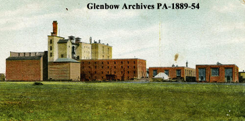
Also around this time the Calgary Brewery expanded. It added the Boiler House and Smokestack, cementing East Calgary as the centre of the city’s industrial activity. A new brew house, additional malt kiln, barley elevator and windmill brought capacity to 450 barrels per day. It was one of the first companies in Alberta to offer pension plans and sickness and accident insurance to its employees.
The Brewery today is slated for a significant mixed-use development, with its heritage assets in an uncertain state.
By the early 1910s, several buildings were constructed in Inglewood that are probably familiar to you.
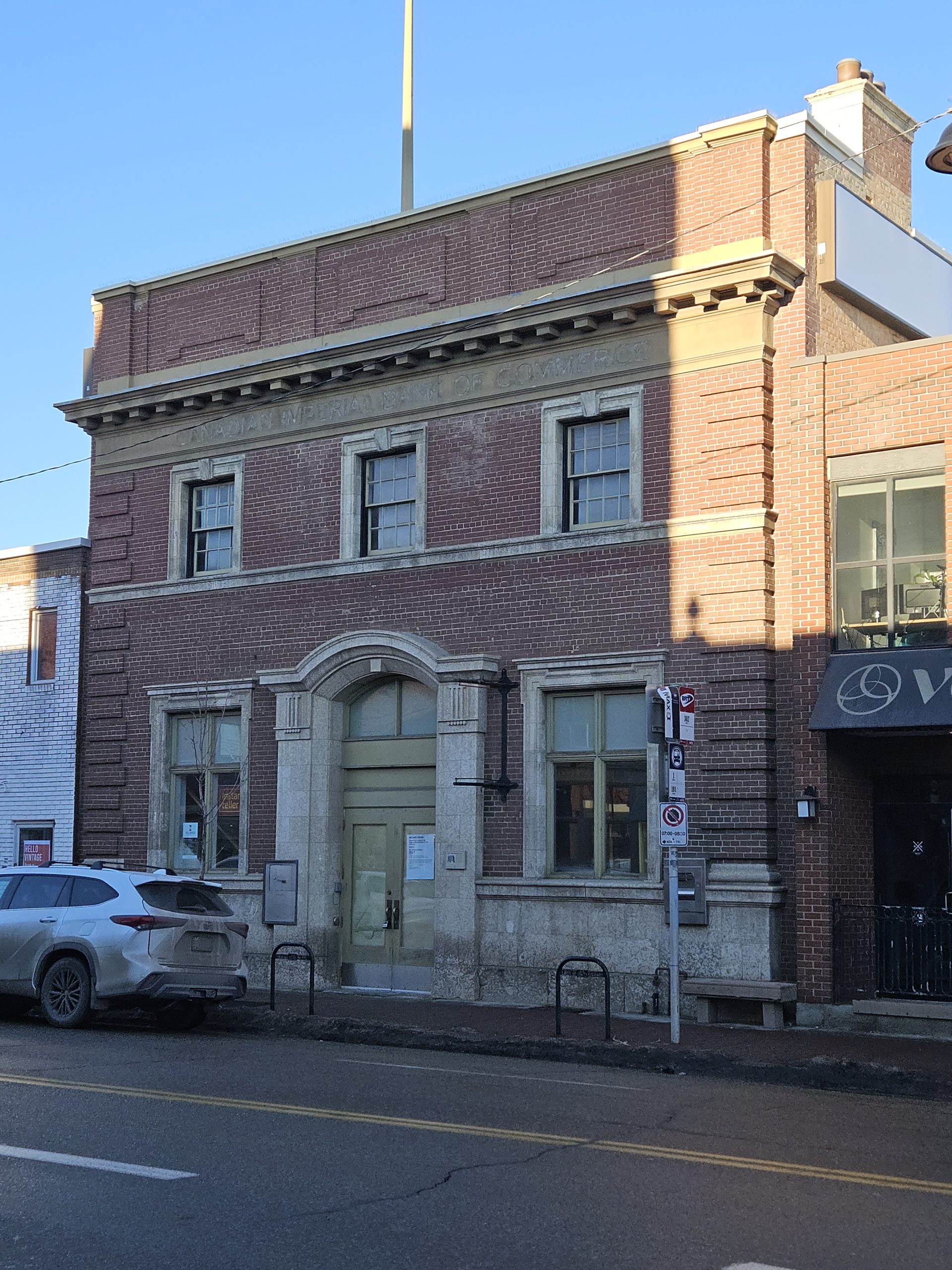
Notable examples are the Burn Block (ca.1912), the largest Edwardian commercial and apartment building on 9th Ave, and the CIBC building (ca.1911), a Classical Revival-style of red brick and Tyndall stone construction. There’s also the Gresham Block (ca.1911, now demolished), a solid brick building with main floor shops and a central staircase to apartments (I’ll have something to say about its demolition in December’s article).
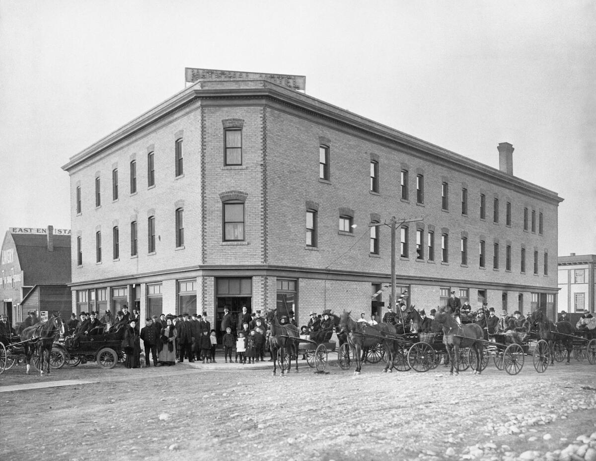
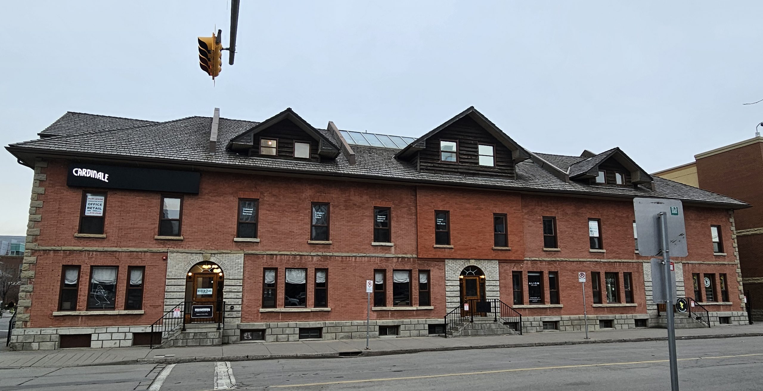
Then there’s the National Hotel (ca.1908). While the old hotels in the downtown core were eventually demolished, the Edwardian-style National stands to this day. It once served as a tavern and hotel for workers and today houses a renowned restaurant.
Next to it is the Livery Barn, a rare example of a prairies hotel and barn remaining together into the 21st century. After everyone switched to automobiles, the barn was used for various auction marts.
One last famous building in Inglewood before moving on.
Deane House was built in 1906 on the site of Fort Calgary for Captain Richard B. Deane, the last NWMP Superintendent in Calgary. Actually it was built for his wife, who did not want to live in the barracks. She took ill and sought treatment on the west coast while the house was under construction. Then she died, and so never got to live in the house.
In 1929, the house was moved across the Elbow to its current location, an effort that was featured in Popular Mechanics magazine. It served as a boarding house, art gallery and today is a restaurant.
Beltline and East Village
Meanwhile, Downtown Calgary was growing on both sides of the tracks. The south side is known today as the Beltline, which is an amalgamation of the Victoria Park and Connaught neighbourhoods. It includes an area called the Warehouse District.
This district is roughly located between 4 St SW and Olympic Way, and between 10th and 12th Avenues. It contained a mix of shops, offices and warehouses along a former CPR spur line. It was close to the main train station and next to the commercial core, serving both east-west rail traffic and the connection to Edmonton.
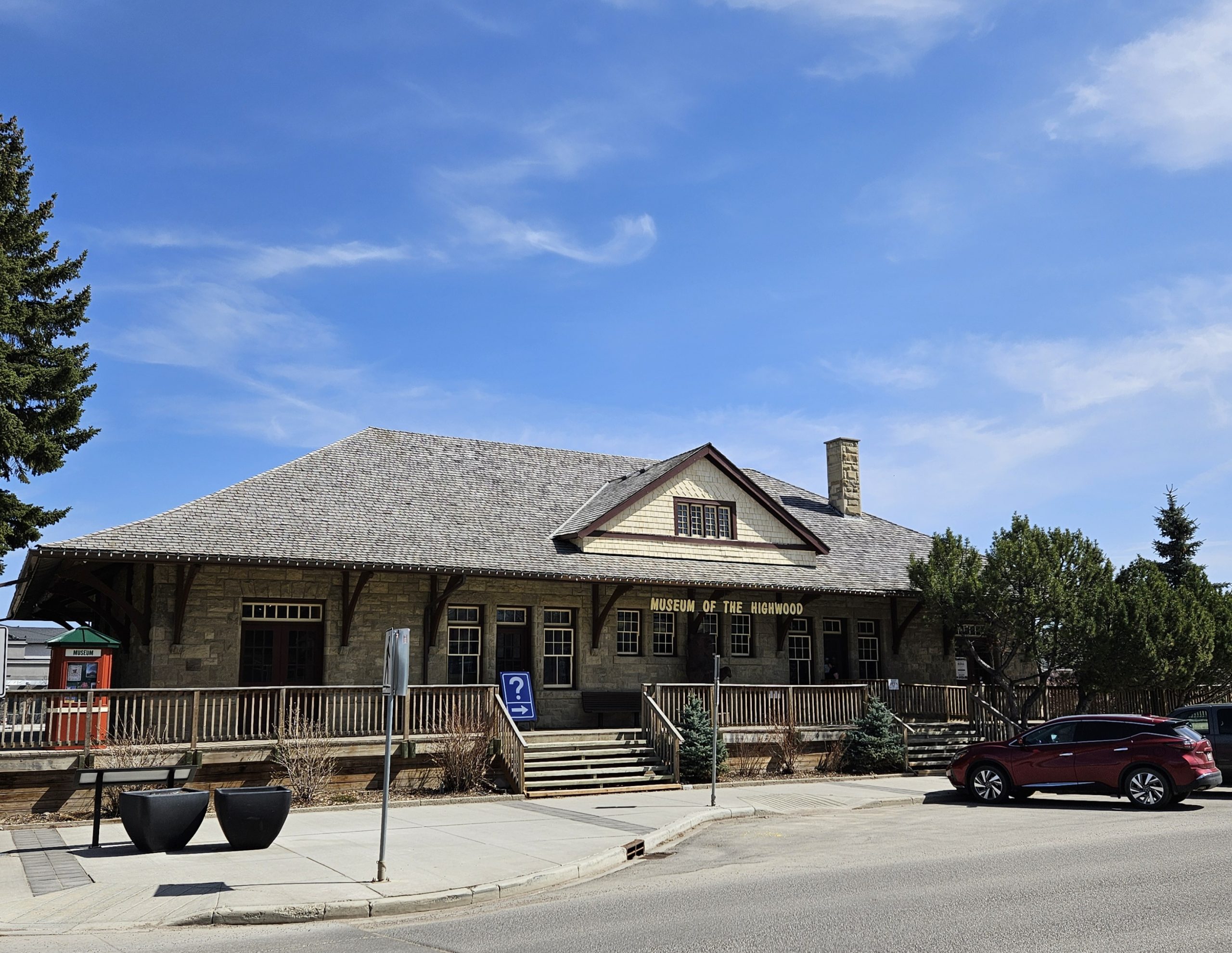
The train station (ca.1893) was dismantled in 1911 to make room for a larger facility. The sandstone buildings were moved to both High River, AB and Claresholm, AB, where they were reconstructed and remain to this day.
Much of the area around the core developed along Calgary’s original streetcar system, which began services with 12 streetcars in 1909 and operated until 1950. By 1910, the system carried a whopping 250,000 passengers per month – Calgary was a city in motion.
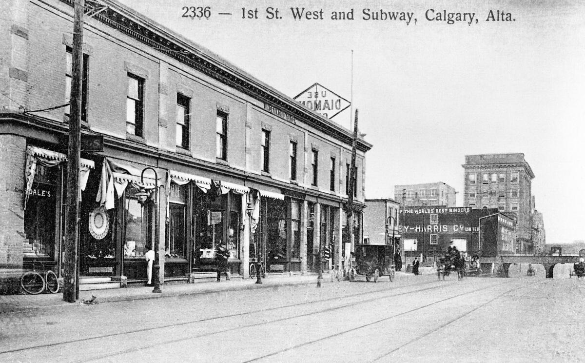
The Beltline neighbourhood takes its name from Trolley No.5, the “Belt Line” streetcar loop route that connected the area to downtown. Several “subways” were built under the CPR tracks for the streetcars, the first two being at 1st St SW and 2nd St SE. The streetcar system was known as the Calgary Electric Railway, which became today’s Calgary Transit.
The Club Carousel building (ca.1905) is typical of the small-scale neighbourhood buildings that developed along the streetcar lines. In 1963, it was the location of Depression Coffee House, which offered Calgarians bohemian culture and originated the city’s folk music scene, with Joni Mitchell the club’s opening night act. In 1969, it housed Calgary’s first gay members’ club, which later became Club Carousel.
Up the street was built the Underwood Block (ca.1905), the first building on 1st St SW. Now demolished, this building was built by contractor Thomas Underwood, who also invested in coal and gas companies and served as Mayor for one term.
The building was an example of the Edwardian Commercial style, with red brick and sandstone banding. It’s associated with Calgary’s second Chinatown. Here, missionaries taught English to immigrants. Restaurants, laundries and grocery stores soon followed.
Next door to the Underwood Block was the Chinese Mission commissioned by Underwood under the guidance of Dr. James Herdman, who brought English language education to the Chinese community. Around it were Chinese boarding rooms, which were moved here when the CPR developed the location of the first Chinatown.
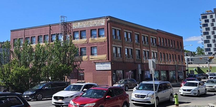
Along with the Underwood Block are other notable buildings in the area, including the Pryce-Jones Department Store. It’s quite a pretty building built for the Welsh mail-order firm Pryce Jones, which opened its only Canadian store in 1910.
When Calgary’s building boom ended in 1915, the store closed. HBC acquired its assets and lent the building for military use during the Great War. There’s also the Romanesque Revival-style J.H. Ashdown warehouse, resembling the other Ashdown hardware warehouses in Winnipeg.
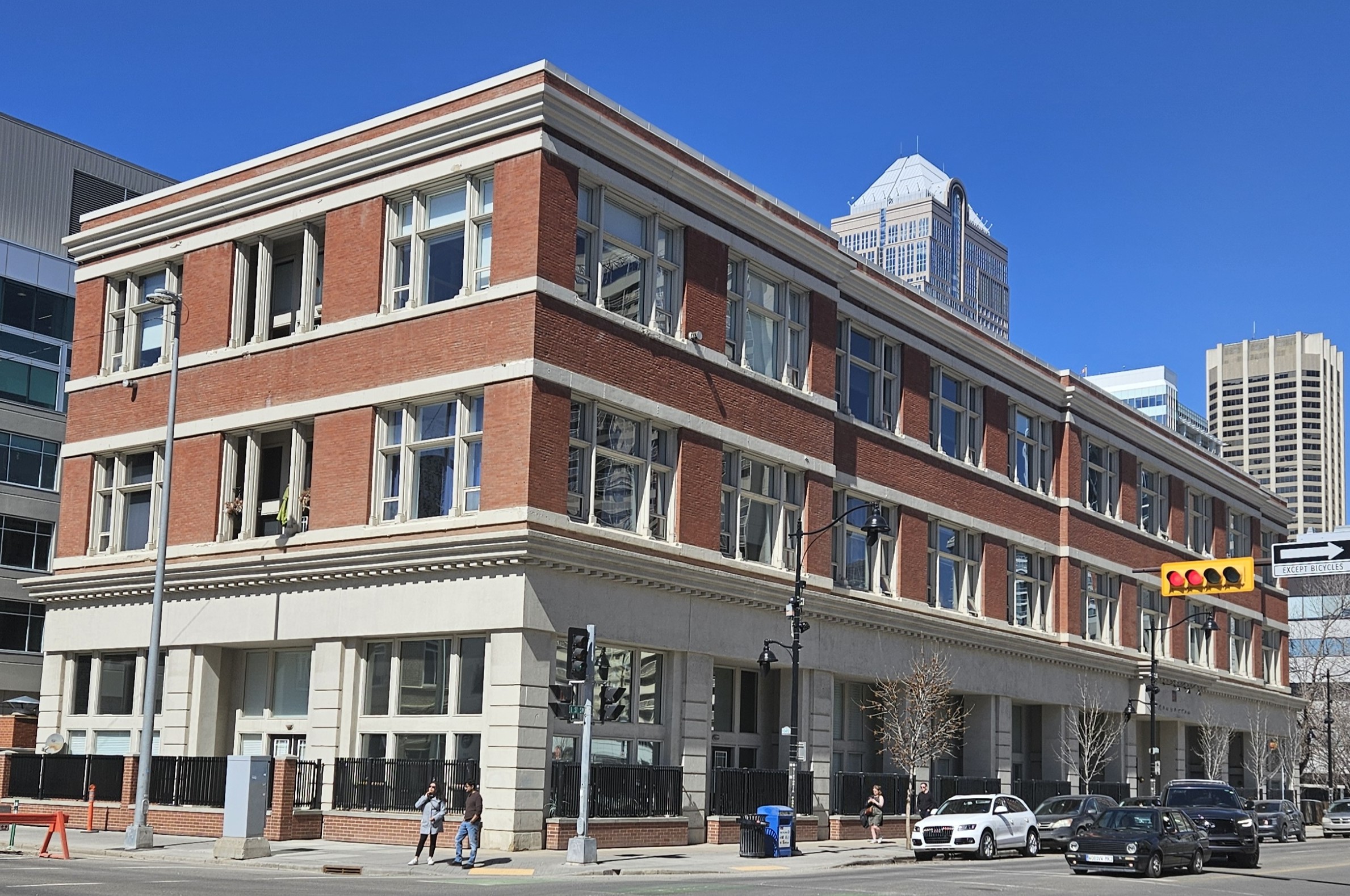
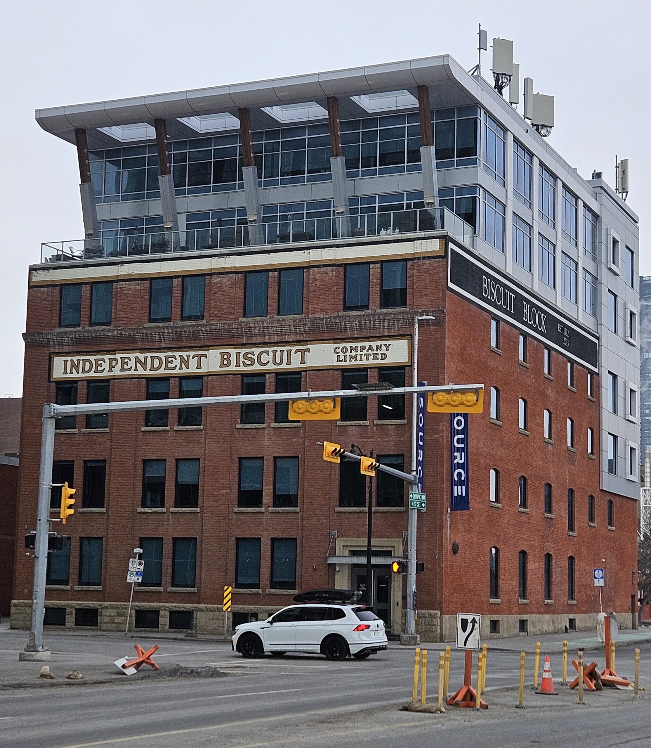
On 11 Ave SE is Neilson’s Furniture Warehouse, later known as the Biscuit Building. Hugh Neilson was a cabinet maker from Ontario who arrived in Calgary in 1894. In 1912, the building was erected to store a wide variety of home and office furnishings. It was converted in 1926 to a manufacturing plant for the Independent Biscuit Co., Calgary’s first biscuit factory. Then it was converted to a six-storey office block in 2013, which preserved its Edwardian Commercial elements and will be a neighbour to the new stadium.
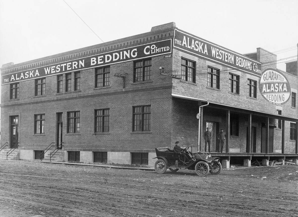
Another light industrial building still standing is Simmons Factory Warehouse in East Village, which manufactured bedding and mattresses, including the Beautyrest line.
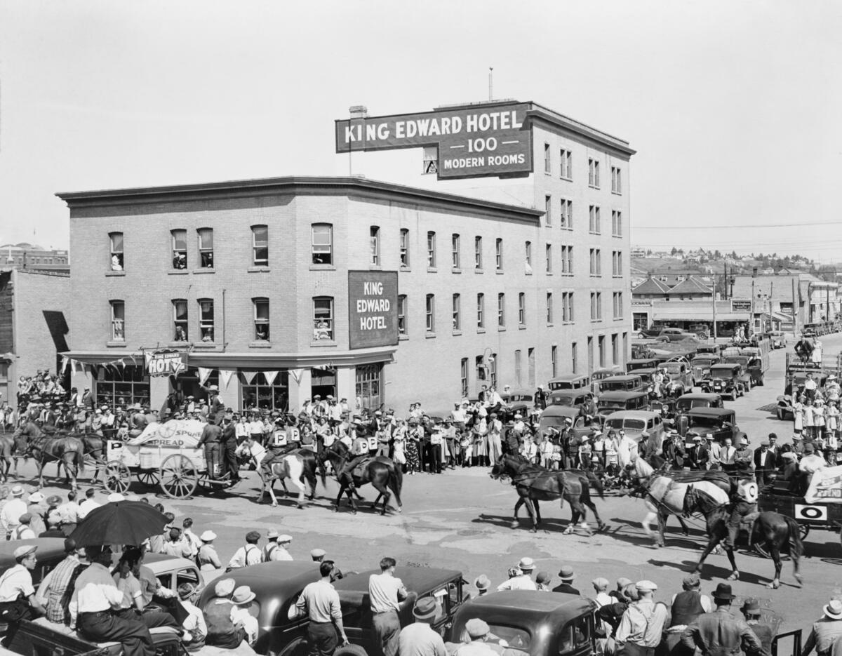
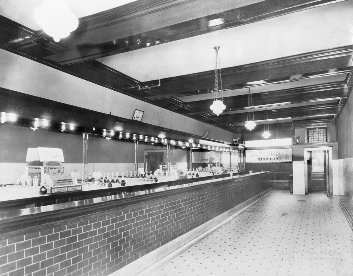
For socializing, the King Edward and St. Louis hotels were big draws.
The King Edward opened in 1905 and was the oldest continually operating hotel in Calgary until it closed in 2004. It was part of ‘Hotel Row’ along 9th Ave, which included the Palliser Hotel near the train station. The King Eddy was priced lower than the Palliser of course, and so became known as a stopping point for working men seeking a place to live.
9th Ave was also called ‘Whiskey Row’, which the King Eddy sustained thanks to bootlegging during Prohibition (1916-1924). Such a sordid reputation stayed with the hotel over its many decades. It was the ‘Home of the Blues’ in the 1980s as Calgary’s first blues bar, which played B.B. King, Otish Rush and Brian Adams. It was closed in 2004, disassembled in 2013, and rebuilt in 2016 as part of Studio Bell’s National Music Centre.
The St. Louis Hotel was built by Major Walker on the site of his 1884 sawmill office and Calgary’s first telephone exchange. It was built in 1914 one year after the Grand Trunk Pacific Railway arrived in Calgary at the site of Fort Calgary. While a station was never built there due to the railway’s financial difficulties, the hotel represents East Village’s brief history as a railway hub.
Because of its proximity to City Hall, the St. Louis was known as a watering hole for civil servants and politicians. Mayors from the 1970s were known to patronize the establishment. Probably its most famous customer was Ralph Klein, who was a patron while a journalist, then while he served as Mayor in 1980s. He was elected the 12th Premier of Alberta in December 1992.
People eventually had to go home from the bars. One nearby residence is Dafoe Terrace, a Georgian Revival-style row house (ca.1910). Calgary area rancher John C. Dafoe constructed it to profit from the real estate boom. It was one of about fifty other blocks erected between 1906 and 1914 in response to the rapidly increasing population.
The area originally attracted semi-skilled and professional workers. But as other neighbourhoods developed, the area became distinctly working class. These kinds of row houses were not favoured in Alberta unlike in England or Ontario. They were thought of as “municipal parasites” by Calgary’s head of buildings in 1912.
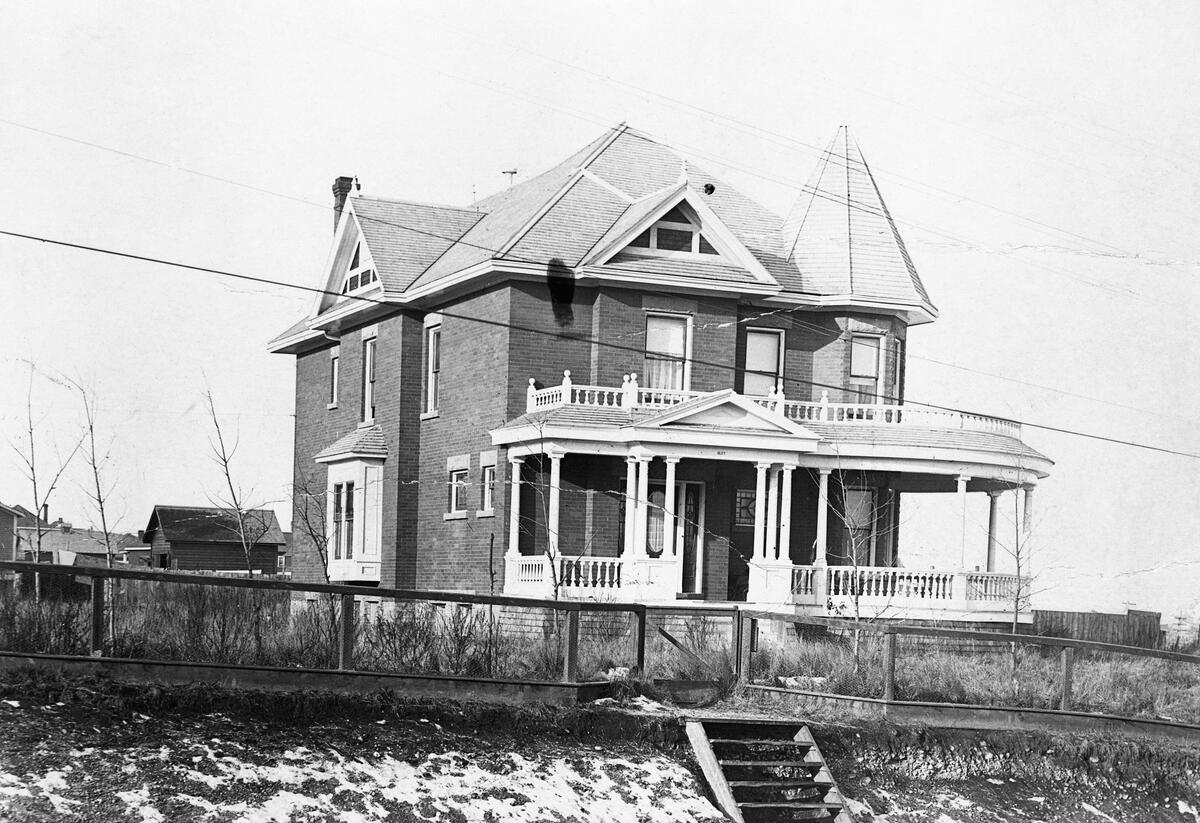
An example of an upper class home in the area is the Albert C. Talbot Residence, one of two surviving Queen Anne Revival-style houses in Victoria Park (today’s East Beltline), which was built by the government’s Surveys Examiner in 1915.
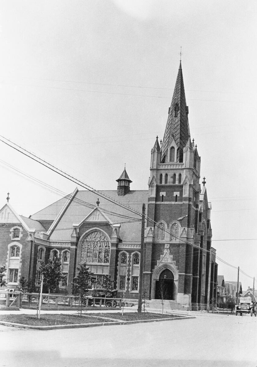
Churches also sprang up at this time.
Calgary’s First Baptist community was established in 1888. They met in several locations and built churches, one of which burned down in 1905. The present Gothic Revival-style church dates to 1912 and was one of about sixty built in the city during the boom times. The land for it was donated by Underwood and future Prime Minister R.B. Bennet.
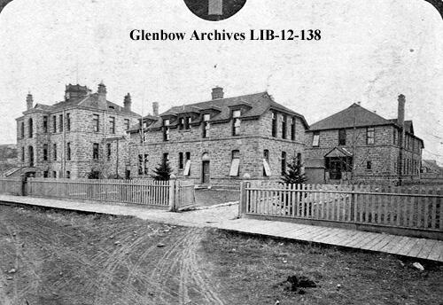
A growing city needs a proper hospital, especially since the cottage hospital was being overwhelmed by disease outbreaks. Upon Calgary’s incorporation as a city, $10,000 was set aside by council for a new hospital.
The Second Calgary General Hospital (CGH) was a 35-bed facility constructed out of sandstone by Underwood and was officially opened on 22 May 1895. The Women’s Hospital Aid Society outfitted the new hospital’s furniture and tools.
It was a state-of-the-art facility, with a designated operating room, signal bell system, electric lights and one telephone. A.E. Cross donated a sterilizer and Calgary Power Co. installed a light outside the front door. A nurse’s school was also established, which graduated its first student, Marion Moodie, in 1898. An adjacent maternity ward was constructed in 1899.
Bridgeland and Sunalta
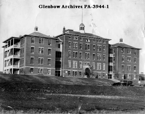
With Calgary continuing to grow, an even bigger hospital was needed. Finally, the land set aside by the Territorial government for a hospital in Bridgeland would be used. The Third General Hospital opened on 1 February 1910, with the Second converted into an isolation hospital.
CGH #3 was a $1.5 million ($40 million in today’s dollars), 5-storey red brick and sandstone structure of 160 beds. It was criticized for being too small from the get-go, but was still state-of-the-art, complete with an elevator, boiler room and laundry machines. It received an X-ray machine in 1913. The sister of famous Canadian humourist Stephen Leacock, Dr. Rosamund Leacock, became Alberta’s first pathologist and was the laboratory director.
Bridgeland-Riverside’s rapid growth due to immigration brought several other developments to the area. Riverside School opened in 1910. Along 4th St NE, the “Trail to Edmonton”, the Armour and Reliance buildings were completed as was the Poffenroth/DeWaal Block.
The Armour was one of the first mixed-use buildings in the area, which housed apartments and a grocery. Later it was the home of a community dance club called Wiggins Hall, after the grocer Thomas Wiggins. Both it and the DeWaal Block housed working class immigrants – Germans, Ukrainians, Russians, Jews, Italians, Dutch and Romanians. Calgary’s first Italian restaurant was also located on 4th St.
The northern part of Bridgeland located along the river escarpment was designed by the firm of Frederick Olmsted, who had designed Central Park in New York City. Down in Riverside, the neighbourhood had a reputation of disrepute due to the presence of a red light district. It was located here because it was outside the city limits but still close to the CPR station.
Rounding out the city at this time were neighbourhoods built around the downtown core. Sunalta, likely meaning “Sunny Alberta”, was established in 1909. Because it was served by the Belt Line streetcar, residences and businesses quickly moved in.
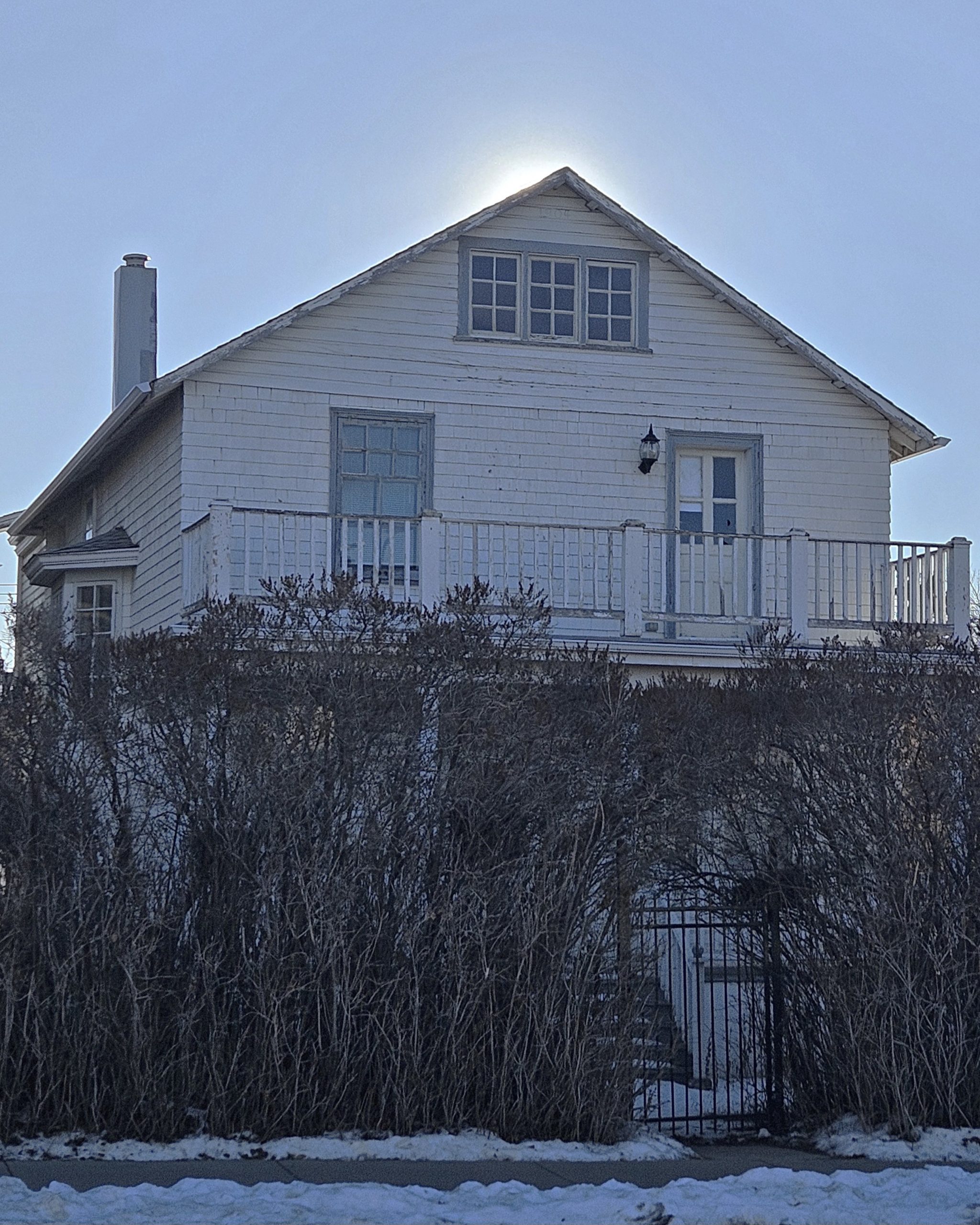
Today the neighbourhood contains rare examples of residences in the Edwardian Gable-Front style. One example is the Weissgerber Residence (ca.1904), originally built along 6th Ave (previously called Angus Avenue), a desirable place to live at the time. The house was relocated to 11th Ave SW in 1949.
Many who lived in the area also ran the local businesses. Hyman Cohen was a Jewish grocer in the area, who was followed by Burns Meats and then Shoprite groceries. Calgary’s first librarian, Alexander Calhoun, was also once a resident of Sunalta.
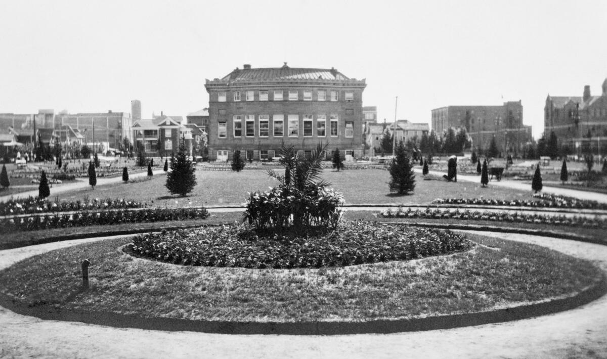
The library he worked at, today’s Memorial Park Library, was originally called Carnegie Library. It was Alberta’s first library when it opened in 1912.
Annie Davidson led the charge to build it as President of the Calgary Women’s Literary Club. She organized a petition to inform city hall of the public’s support for a library. Andrew Carnegie, an American steel business owner, offered $80,000 (about $2 million today) to build the library, with the city and province providing the books and maintenance.
The site chosen for the library was in Central Park, which was designed in 1889 in the Victorian style. The park and library became a National Historic Site in 2018.
South of Sunalta was ranchland. Isabella and William Nimmons owned 3-D Bar Ranch, which extended from 17th Ave to 26th and from 14th St to Crowchild Trail. They built Nimmons Residence in 1898, the first house in Bankview and one of the first in Calgary to use red brick.
William had surveyed prior to arriving in Calgary, a task for which he was briefly imprisoned by Louis Riel in 1869. The quarry on his property supplied sandstone for Lougheed House, Carnegie Library and many of Calgary’s schools.
During this time, several brickworks were established, one of which was located in an area once known as Brickburn.
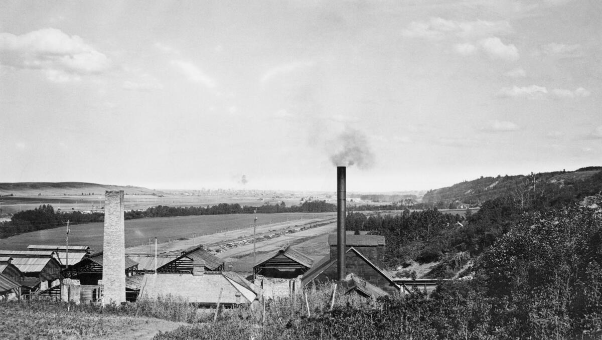
The kilns there turned out 45,000 bricks per day, which supplied materials to major buildings like Mewata Armouries. One hundred workers lived onsite, giving the area near today’s Edworthy Park its nickname. On the Bow River near the park are some Douglas fir trees estimated to be approximately 500 years old.
Crandell House is still located onsite, originally built in 1905 as a British Arts and Country style retreat for Edward H. Crandell, a real estate and insurance industry businessman. Judge Harry Patterson owned the house after Crandell, giving today’s community of Patterson Heights its name. It was then owned by Stu Hart of Stampede Wrestling fame.
Leave a Reply