

Welcome! The Calgary Heritage Initiative presents a series of articles throughout 2025 commemorating the 150th anniversary of the construction of Fort Calgary at the confluence of the Bow and Elbow Rivers, an important meeting place for people for millennia. Each month we’ll present one era in Calgary’s history.
Sign up to CHI’s newsletter and join us to explore the history and heritage of our region.
Fort Calgary
1810 to 1875
The arrival of fur traders to Alberta began a series of fundamental changes that continue to reverberate today.
Trade
For First Nations, the seasonal round across the plains and back to the foothills defined their culture and daily life. As more fur trading posts were established, access to manufactured goods brought conveniences. Firearms were very effective for buffalo hunting. So was the domesticated horse.
Meanwhile, Europeans and Métis continued to expand the fur trade. The work resumed after several violent interactions (for example, see the Battle of Seven Oaks/Frog Plain), which forced the government to merge the North West Company with the Hudson’s Bay Company (HBC) in 1821. The new HBC had monopoly privileges and de facto administration over both Rupert’s Land and the North-Western Territory, all the way to the Pacific Ocean, covering one-twelfth of the world’s landmass.
By 1826, the new chief factor at Fort Edmonton, John Rowand, was increasingly focused on competition from the trade between the prairie’s Indigenous peoples and the American presence in what was known as the Wild West.
In 1832, HBC packed up Rocky Mountain House and established a post near Morley, AB called Piegan Post. It was meant to foster trade relations with the Piikani and compete with the Americans, but it was abandoned after only two seasons. The trade was unsuccessful and the fort was attacked several times due to rivalries between tribes. The Tsuut’ina then burned it down, with the site becoming known as Old Bow Fort.
Despite its short existence, the fort’s location became a known entry point into the Bow Valley, a named spot on travellers’ maps where they could change transportation. After using a wagon across the prairies, it was a good place to switch to pack animals for travel through the foothills and into the mountains.

Ruins of Old Bow Fort, near Morley, AB, ca. 1900 (Glenbow Library and Archives Collection)
Missionaries and Explorers
Many newcomers made their way through Old Bow Fort. In 1841, Robert Rundle, a Methodist priest and HBC chaplain, arrived in southern Alberta. At first, HBC Governor George Simpson thought church sermons would interfere with company business. Competition with the French led him to avoid Roman Catholic missionaries, and the Anglican clergy were operating independently. To improve living standards and maintain the government’s support, he eventually invited the Methodists to sermon at HBC forts in the West.
Rundle wintered at Fort Edmonton and then in summertime headed south. He met with Indigenous leaders, but was not accepted at Blackfoot nor Piikani camps. At first he was guided by HBC officers, like Rowand. When he became sufficient in Cree, Rundle travelled with Métis interpreter William Rowland and also Benjamin, son of Cree Chief Maskepetoon (“Broken Arm”).
In 1844 and again in 1847, Rundle proceeded towards the Rockies and became a missionary to the Stoney and Cree. During one of his travels, he met Paul Kane, an artist who produced over 100 oil paintings about life in the Northwest during the mid-19th century. Today, Rundle’s mission on Pigeon Lake is a National Historic Site.

Mt. Rundle and Banff-Windermere Auto Road, 1925 (Mountain Studies Collection, Libraries and Cultural Resources Digital Collections, University of Calgary)

Fort Edmonton, by Paul Kane. Held at the Royal Ontario Museum, Toronto (Art in the public domain)
Soon after, the Métis, voyageurs and some Indigenous people requested sermons by the Catholic Church. Bishop Joseph-Norbert Provencher of Saint-Boniface, MB sent Priest Jean-Baptiste Thibault to Fort Edmonton in 1842. The mission was not approved by HBC and so Thibault became one of the first Europeans to travel into the region on horseback rather than canoe. He preached in the region for 10 years and was more successful than Rundle in forming a relationship with the Blackfoot. He also established Lac Ste. Anne, Manito Sakahigan (“Spirit Lake” in Cree), as a pilgrimage site for Catholics.
Manito Sakahigan was an ancient gathering place for Indigenous peoples as it’s flat and extends down to the lakeshore. Because of Thibault, it became a place where Cree, Dene, Blackfoot, Métis and others met to celebrate the Feast of Saint Anne in July, which overlapped with the seasonal round’s summertime celebration of the grandmother spirit (St. Anne is revered as the mother of Mary, Mother of Jesus). The area is now a National Historic Site.
Others arrived in southern Alberta on a mission from government rather than God.
John Palliser was from Ireland and served his family and county as high sheriff, justice of the peace, and then as Captain in his father’s regiment. He became enthralled with stories of the buffalo hunt on the American plains and visited in 1847. After publishing his adventure, and eager to return, Palliser joined the Royal Geographic Society and submitted a plan to explore the southern prairies and adjacent Rocky Mountains of British North America.
Around this time, the potential of the Canadian prairies was on high society’s radar. The government was also growing concerned about American expansionism in the region. Because of these considerations, Palliser’s exploratory hunting trip became a full expedition. Scientists, including Scottish geologist James Hector, Swiss botanist Eugène Bourgeaux, and Irish astronomer John William Sullivan, were added to the plans, with Her Majesty’s Government providing the funding.

Captain John Palliser and Sir James Hector, ca. 1857 (Glenbow Library and Archives Collection)
Palliser was charged with several tasks. One was to find travel routes entirely within British North America between British Columbia and the Province of Canada. Another was to ascertain the region’s agricultural suitability. This was a matter of some debate since there was little dependable information and many did not believe HBC’s accounts of the region.
While the government in Ottawa was preoccupied with the Red River area (modern-day Winnipeg), Palliser went further west. By the summer of 1857, he met Métis guide James McKay. McKay had previously guided HBC Governor Simpson on trips to Manitoba and went on to serve as a minister in the Manitoba government and was an advocate for Indigenous peoples on the Council of the North West Territories. He led Palliser as far as Fort Carlton, SK for the winter.
In the spring, Palliser travelled to southern Alberta and entered the Rockies at the North Kananaskis Pass and returned by the North Kootenay Pass. He wintered at Fort Edmonton and befriended the Blackfoot and Piikani peoples. In summer, he travelled through their territory to Cypress Hills before canoeing down the Kootenay River and eventually arriving at Victoria for the trip home, which he reached in 1860.
One result of the Palliser Expedition was the dissemination of knowledge about the Canadian prairies throughout the centres of science and politics at the time. This included knowledge of a fertile agriculture belt suitable for cattle and cultivation that bordered a larger, more arid district, a steppe-like region with little precipitation. The region encompassed the area roughly between Lethbridge through Medicine Hat toward Swift Current, SK, known today as Palliser’s Triangle.
Besides the environmental conditions, the Expedition clarified that building a railway in British North America across the Canadian Shield, through the prairies and over the Rockies would be prohibitive, but it was possible. Palliser also warned that Indigenous peoples’ reliance on the buffalo’s annual migration was in conflict with plans for wide-spread settlement.
Indigenous peoples themselves also tried to warn away various hunting parties moving through their territory. During one exploratory hunting party in 1860, Assiniboine Chief Red Stone and his Cree allies told a British audience of soldiers and hunters, “Sometimes, we have trouble in feeding our families and yet you think you can come here and shoot down our buffalo. You would take food out of the mouths of my children, just for your pleasure…Don’t come again” (p.42, MacEwan, Buffalo: Sacred and Sacrificed). The hunters rode away after their scolding, but they did not stop coming.

Map showing the extent of Palliser’s Triangle in Western Canada (NormanEinstein, 2005, via Creative Commons Attribution-Share Alike 3.0 Unported license)
Settling
While governments and scientists poured over reports, the Métis began establishing a more permanent presence in southern Alberta, no longer staying tied directly to the trading forts up north. We know this from Métis scrip records, which show people being born in the Bow Valley by the 1850s. (Note: perhaps the earliest date for a Métis’ birth in the Bow Valley was St. Pierre Dumont in 1841)
The scrip land grant system was devised for the Métis by the Canadian government to exchange paper scrips for money and land. However, it was convoluted and many did not receive what was promised.
The failed scrip system was not the only impact on Indigenous peoples from the inflow of people into the region. Raids and wars were fought between Indigenous bands over trade routes. And even though trade had benefits in terms of access to goods, it also had its downsides. Between 1864 and 1870, diseases unknown to the region devastated the Siksika people. The spread of disease occurred alongside a rapid decrease in the size of the buffalo herds due to persistent hunting all across the Great Plains.
Another problem was an increase in alcohol consumption. As the fur trade declined, what with beaver pelts going out of fashion in Europe, American traders from the Oregon and Montana Territories began arriving into the region. They were known for their predominant item for trade, whisky, and began establishing trading forts.
One of these was Fort Whoop Up in Lethbridge, built in 1869 near the confluence of the Oldman and St. Mary’s rivers. Originally called Fort Hamilton, it was linked to Fort Benton, MT along the Whoop-Up Trail by the employees of I.G. Baker Company. The company’s men built the fort outside the United States because they were forbidden by U.S. law to trade whisky for furs and buffalo hides with Indigenous peoples. Another fort was built at Blackfoot Crossing, near today’s Cluny, AB, in 1874.

Blood at Fort Whoop-Up, AB, ca. 1878-1879 (Glenbow Library and Archives Collection)
Following the whisky traders was the notion of American expansionism. In 1855, the U.S. Government and Blackfoot Confederacy signed a treaty to establish a reserve in present-day Montana. Over time, the pressure from more Americans arriving into the area, in part due to the discovery of gold, meant the U.S. Army was sent in. One result was the Marias Massacre.
Conflict between newly-arrived ranchers and Indigenous peoples in Montana had been simmering for years, with horse stealing and settlement raids increasingly common. Then a prominent rancher was killed in 1870 by Piikani warrior Owl Child. Outraged ranchers demanded the government intervene.
The U.S. Army tried to locate Owl Child and other leaders. When they received intelligence on the location of a camp of hostile warriors, they attacked. But rather than happen upon warriors, the camp contained people sick from smallpox and the young, with most of the healthy men away hunting. 217 people died in the attack. Outrage afterwards convinced President Ulysses S. Grant to refuse the U.S. Army control over Indigenous affairs, instead choosing civilians and missionaries.
The conflict largely ended afterwards. The Blackfoot were sick with disease and fearful of further American reprisals from resistance. They were forced to accept settlement on a smaller reserve, though some, including Chief Sitting Bull, decided to relocate to Canada.
First Calgarians
Meanwhile, the Calgary area was seeing its earliest settlements, with several groups active roughly around the same time in the 1870s.
One of the first Europeans to arrive was John Glenn. Born in County Mayo, Ireland, Glenn resigned from the Confederate Army in protest over slavery and fought with the Union in the American Civil War. He then worked in mining before finding himself part of the Cariboo Gold Rush in Bakerville, B.C. (once the largest city north of San Francisco and west of Chicago. Today, it’s a preserved historic town).
He then met a Métis woman, Adelaide Belcourt of Lac Ste. Anne, whom he married at St. Albert, AB. Starting in 1873, and when not trading at Fort Benton, the family farmed near the confluence of the Fish Creek and Bow River. He said of the area, “I like the climate better than any I have found between the Atlantic and the Pacific, the Rio Grande and the Peace”. Sounds like 1873 was a good year!

The John Glenn Ranch, near Calgary, ca. 1884-1885 (Glenbow Library and Archives Collection)
As he traversed the Rocky Mountains in 1872, Glenn happened upon the railway survey mission of Sandford Fleming. Fleming had been involved in a rail route from Toronto to Georgian Bay, and was then chief engineer of the Intercolonial Railway between Canada and the Maritimes during the U.S. Civil War. When B.C. was promised a railway connection for joining Confederation in 1871, Sandford was sent out west to survey a route for the Canadian Pacific Railway, a project that would change the prairies forever.
Another group to arrive were led by members of the Roman Catholic Church. As noted, missionaries had started arriving in the 1840s. By 1852, Father Albert Lacombe was in Fort Edmonton and Lac Ste. Anne, working with the Cree and Métis all throughout the region, even as far north as Lesser Slave Lake. He wanted to expand the mission at Lac Ste. Anne, but the land was unsuitable for agriculture and the Cree refused Lacombe’s call to abandon the seasonal round.
He decided to find a more suitable site for his mission and in 1861 founded St. Albert. Today, Father Lacombe Chapel claims the title of Alberta’s oldest building.
At the new mission, Lacombe built a flour mill and then a school at the nearby Fort Edmonton. He evangelised to the fort’s employees and to the Indigenous peoples who came to trade, and otherwise he travelled extensively throughout the prairies. He met Chief Crowfoot in 1865 and co-translated the New Testament into Cree at Rocky Mountain House in 1870.

Mission, St. Albert, AB, 1877 (Glenbow Library and Archives Collection)
Leon Joseph Doucet then arrived from France to study under Bishop Vital-Justin Grandin, who was appointed bishop of the Diocese of St. Albert in 1871. Doucet completed his studies in 1870, becoming the first ordained priest in Alberta.
Father Doucet worked with the Cree of central Alberta before being assigned south to establish in 1872 Notre-Dame-de-la-Paix (today’s St. Mary’s Cathedral), Calgary’s first permanent mission. It comprised Francophone Métis and French Canadians. Among them were brothers Charles and Édouard Rouleau, hence the former name for the present-day community of Mission, Rouleauville (Note: while not all Métis in the Calgary area at the time were francophones, virtually all the early Francophones of Calgary were Métis).
Starting in 1869, former HBC employees and other Métis Freeman bands started arriving in the Calgary area. One family was Antoine Godin and Susanne Bruneau, likely the first permanent residents of Calgary. They were followed by the Ward and Boucher families. Some Métis established homesteads at Shaganappi Point and others did so along the Elbow River south of its confluence with the Bow.
Along the Elbow, Métis established river lots that extended eastward from the river, which are present on the first township maps of the area. Baptiste Anouse had land and the Rouselle and Tessier homestead was also present from Calgary’s first days. Godin is likely to have been the first owner of the land where Hunt House sits today, next to Deane House in Inglewood.

Plan of township no. 24, range 1 west of fifth meridian, 1883 (Historical Maps Collection, Libraries and Cultural Resources Digital Collections, University of Calgary)
To Be Continued Later this Month
– Anthony Imbrogno is a volunteer with The Calgary Heritage Initiative Society/Heritage Inspires YYC
– All copyright images cannot be shared without prior permission
Addendum
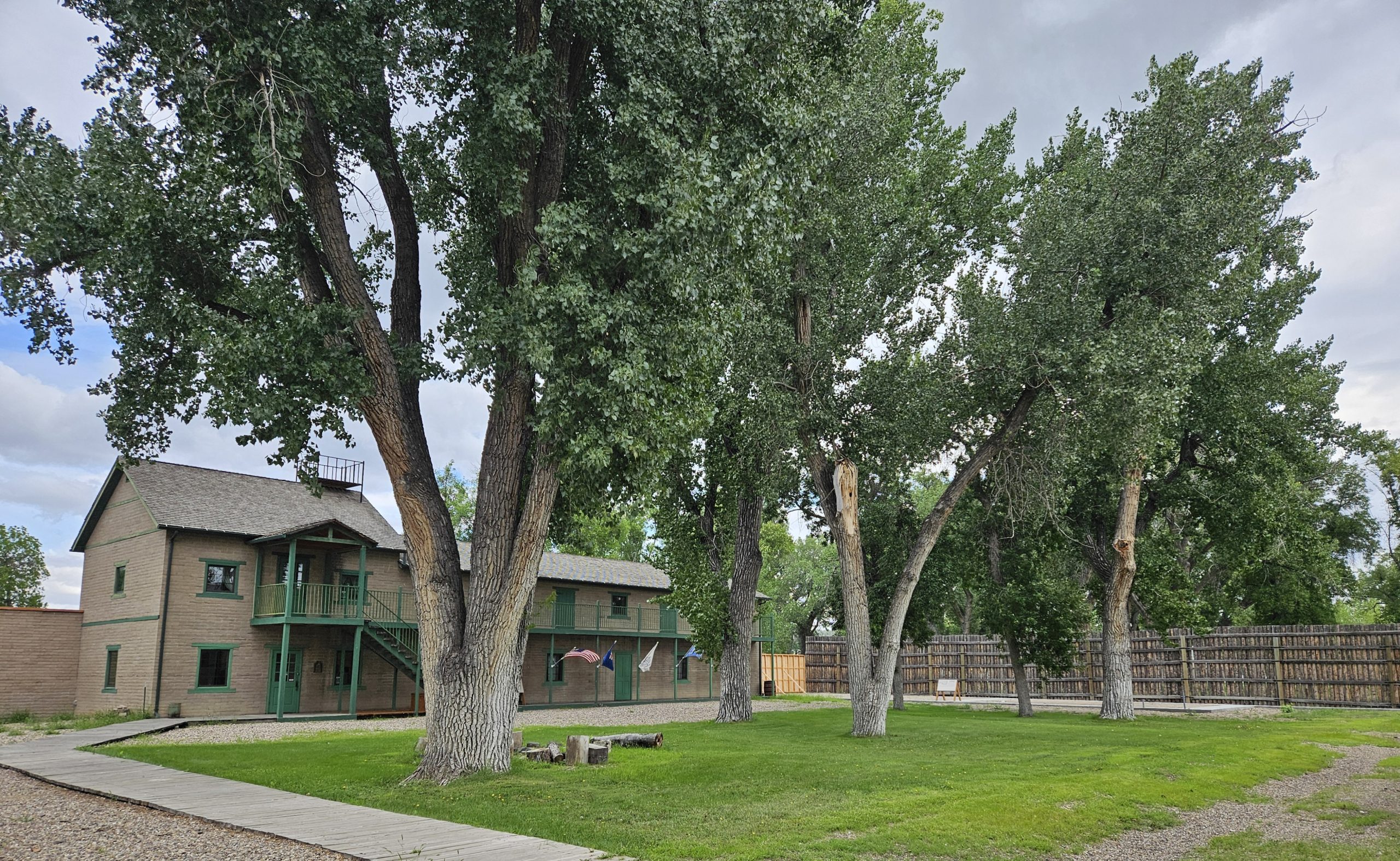
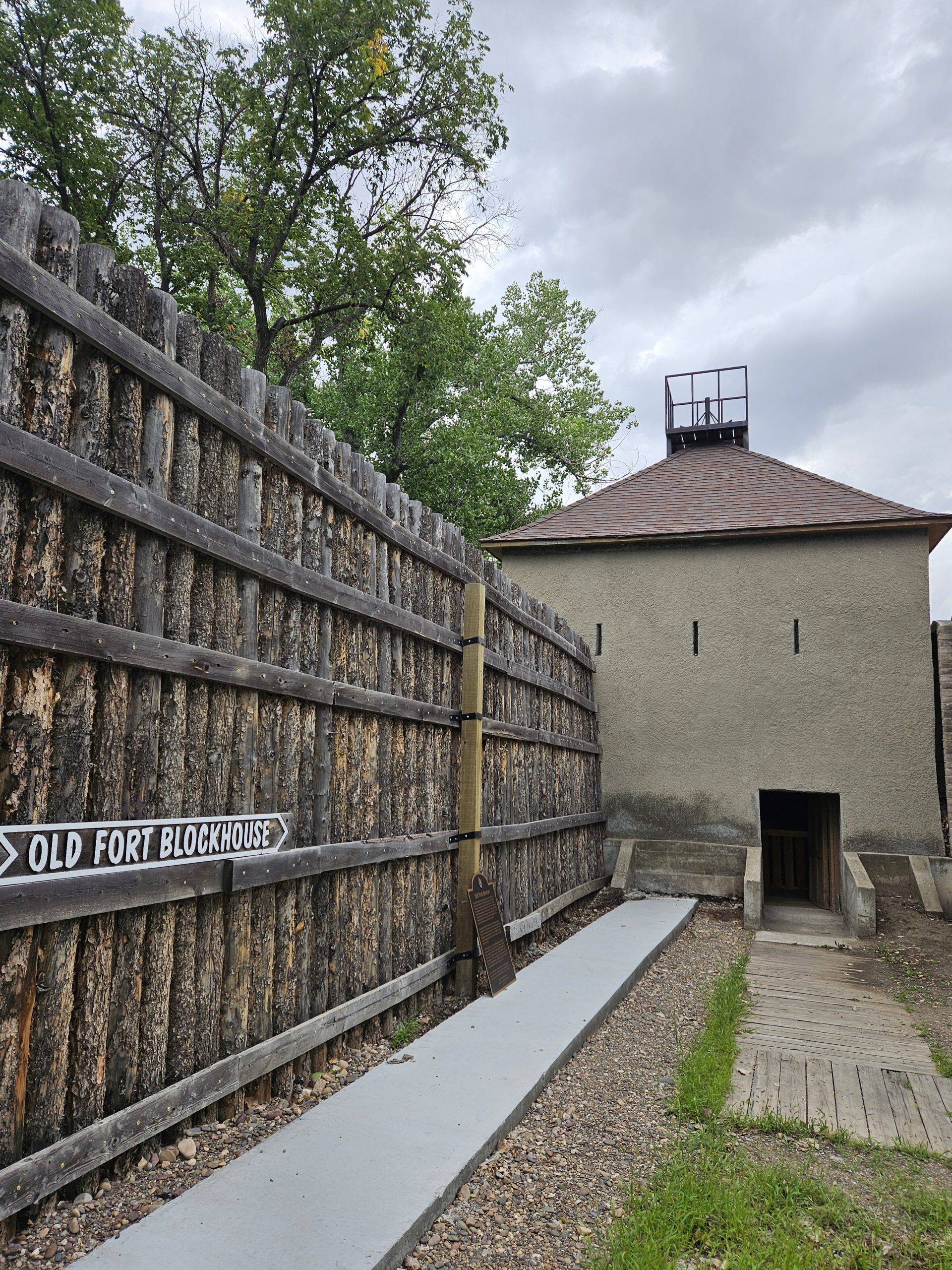
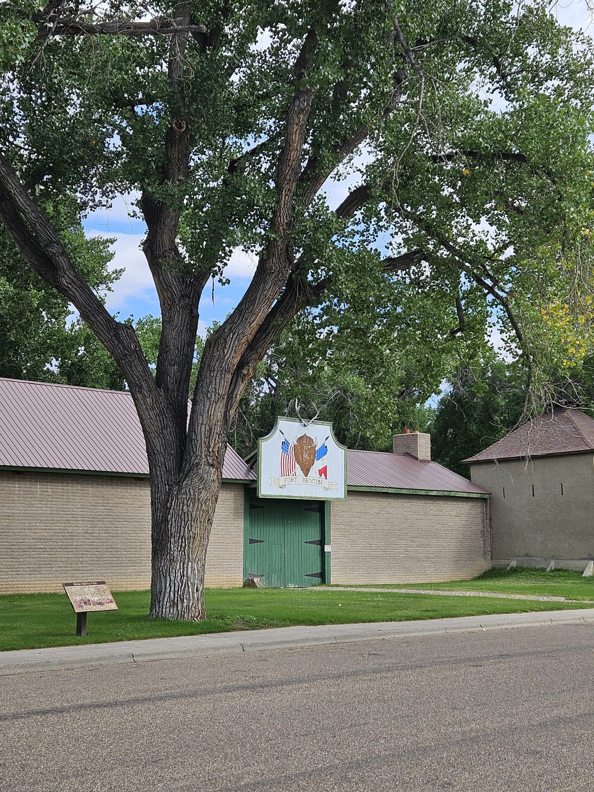
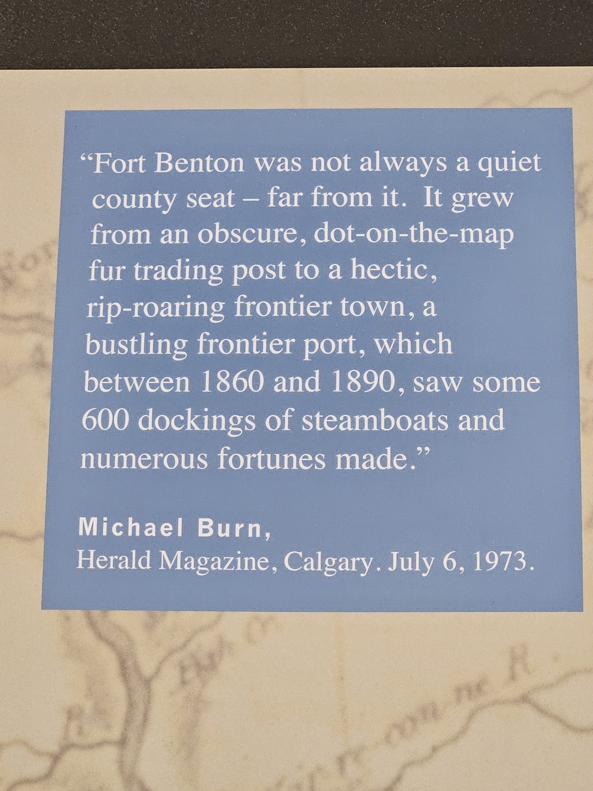
The following photos were taken during a trip to Fort Benton, MT:
“While governments and scientists poured over reports, the Métis began establishing a more permanent presence in southern Alberta, no longer staying tied directly to the trading forts up north. We know this from Métis scrip records, which show people being born in the Bow Valley by the 1850s.”
First off, thanks so much for mentioning this! I feel like Calgary’s history as a Metis wintering site and – later – settlement is one of the most overlooked aspects of local history.
Second, the earliest date I have for an unambiguous Metis birth in the Bow Valley was St. Pierre Dumont, who was born “along the Bow near Morley” in 1841. From that point on, there appears to be a small but stable seasonal community of Metis in the area.
Hi I wAs curious if John Glenn’s ranch was what was to become MacLeod tr.?
Initially, no. His first farm was located at the mouth of Fish Creek, where the Bow Valley Ranche is today. However, the government purchased the property for an instructional farm in 1879, so the Glenns took up a new stead further up Fish Creek. Macleod Trail runs through their second ranch.
Also, I want to point out an issue with the claim “three groups [were] active roughly around the same time in the 1870s”. Namely that “ The second group to arrive were Francophones” while the “ The third group were the Métis.”
While not all Metis were francophone, the early Francophones of Calgary were almost exclusively Metis. Of approximately 100 people within the modern city limits who were recorded as “French” on the 1881 census, only three – Henri Pacquette, Louis Rousselle, and Fr. Leon Doucet – were from Quebec or France. The balance of “French” people enumerated in that census, ~97%, were born in Manitoba or the territories and took scrip. That is to say, by and large, Calgary’s early francophone community was a subset of its Metis community, not a separate entity.
Thank you very much for the information. The text has been adjusted to reflect this.